Quantcast
Channel: SKYE on AOL
Viewing all 4069 articles
Browse latest View live

Snowstorm to Strike Northeast; New England Braces for Blizzard

$
0
0
Wednesday, March 12, 2014
Northeast Snow
(AP Photo/Gene J. Puskar)

Despite a springlike start to the week, winter and substantial snow will make a comeback across the Midwest and Northeast at midweek.

A winter storm began to take shape over the Lower Midwest states Tuesday night, spreading snow from Kansas City through Chicago. This storm will track into the Northeast and Atlantic Canada on Wednesday through Thursday.


By Wednesday morning, more than 34,000 were without power in northern Illinois while more than 6,000 customers were without power in Chicago alone.

The storm will drop a swath of substantial snow along the cold side of its path, threatening to cause yet another round of disruptions to travel and daily routines. Parents should prepare for a day or two of school cancellations in the areas hit the hardest.


The corridor from northern Illinois to northern New England has the greatest potential of being targeted by the substantial snow.

While a plowable snowstorm is anticipated across parts of the Midwest and Ohio Valley, the heaviest snow will target interior New England. Totals can exceed 1 foot in northern New England, where near-blizzard conditions may evolve.

Along the northern New England coast, the snow may first mix with or fall as rain.


Motorists can anticipate difficult driving conditions on lengthy stretches of highways and interstates. The snow could come down heavily for a time, quickly clogging roads and making travel treacherous.

RELATED:
2014 Forecast: Severe Storm and Tornado Threat to Spike in May, June
Plains to East Warmup Precedes Next Winter Storm
Winter Shatters Expense Records in North


Numerous flight delays and cancellations can be expected throughout the Midwest and Northeast with potential ripple-effect delays elsewhere in the United States.


The storm will initially spread mainly rain across communities around the Ohio River and along the I-95 corridor from Providence, R.I., to New York City to Washington, D.C.

However, colder air plunging southward on the back side of the storm may set the stage for the rain to end as a period of snow and/or cause any wet spots on untreated roads and sidewalks to turn icy.

Such danger will unfold across the Ohio Valley on Wednesday, then shift to the I-95 corridor on Wednesday night and Thursday morning.

RELATED ON SKYE: 50 Incredible Photos of Forces of Nature
Volcano Eruption


Permalink | Email this | Linking Blogs | Comments


2014 Forecast: Severe Storm and Tornado Threat to Spike in May, June

$
0
0
Wednesday, March 12, 2014
Mammatus clouds
(Getty Images/Flickr RF)

Persistent cold air during the first part of the spring is likely to cause severe weather to get off to a sluggish start in a heavily populated part of the nation. However, a marked turnaround is expected later in the spring for 2014.

On average, severe weather gradually ramps up moving forward through the spring. This year, the transition may occur later and may be more dramatic.

A spike in damaging thunderstorms, including some capable of producing tornadoes, is expected during May and June.

Early Season Temperature Extremes

According to AccuWeather long-range weather expert Paul Pastelok, "We expect a southward dip in steering-level winds to occur much of the time over a large part of the Midwest to the Eastern states during March and the first part of April."

This dip of strong winds high in the atmosphere, known as a jet stream trough, will generally keep warm, moist air at bay from near the Mississippi River to the Atlantic coast.

Last year, a similar setup occurred in much of the same area during the spring and led to a much lower-than-average severe weather season for the nation as a whole.

Thunderstorms are fueled by rising warm, moist air. As a general rule, the lower the temperature near the ground, the lower the risk for tornadoes and violent thunderstorms.

"This year, the ground is colder, the Great Lakes have an extensive amount of ice and the Gulf of Mexico waters are starting off colder than average," Pastelok said. "All of these can have a negative impact on temperatures in the lower atmosphere."

Over much of the Southeast, Midwest and Northeast, the tornado risk will be lower than average early on due to the colder-than-average environment expected.

RELATED:
AccuWeather Severe Weather Center
The Difference Between Tornado Watches and Warnings
Strong Storms to Threaten Philly, DC, Raleigh Wednesday

According to severe weather expert Dan Kottlowski, "As a positive note, we may not see the frequency and violence of severe thunderstorms and tornadoes that typically occur during March and much of April, because of the lingering chill impacting a significant part of the nation."

However, Kottlowski urged caution when comparing overall numbers of tornado and other severe weather incidents to other seasons.

"This is not to say there cannot be a couple of outbreaks of severe weather during the first part of the spring in portions of the Midwest, the South and even the Northeast," Kottlowski said. "People should not let their guard down."

Even during a minor severe weather event, all it takes is one tornado hitting a populated area to bring the potential for great loss of life and destruction.

Strong storm systems can exploit temperature extremes. These storms can allow building warm, moist air to surge in just long enough to trigger an outbreak of severe weather in an otherwise predominantly cool weather pattern.

There is one area where severe weather may get off to an early, typical start with the possibility of frequent severe weather events during March and April.

In portions of Texas, Oklahoma, western Arkansas and western Louisiana, Kottlowski and Pastelok both expect warmth to build quickly relative to the balance of the Central and Eastern states.

The AccuWeather long-range team has concerns for flooding over part of the Tennessee and Ohio valleys with this setup, however. Weakening thunderstorms could unload heavy rain as they move farther east and unwind in the semi-permanent cooler air.

Dramatic Pattern Change Later in Spring

Pastelok and Kottlowski expect the pattern from the Mississippi Valley to the East to change significantly during May and June and correspondingly expect a spike in severe weather incidents to progress northward and eastward.

"We expect a normal to perhaps an above-average amount of severe thunderstorms over the Central states during May and June," Kottlowski said.

Indications are that the jet stream will pull to the north during May and June and hence will allow warm, moist air to flow northward more regularly over the Midwest.

"While warmth combined with drier air may keep a lid on severe weather for a time in the East during May, the air should be thoroughly warm and moist over much of the Midwest and South Central states," Pastelok said.

Areas from the Dakotas and Minnesota to Wisconsin, Michigan, the Appalachians and Atlantic coast should experience surge of severe weather during June and July.

A significant number of severe weather events are likely to continue to occur over the balance of the Midwest and South Central states and expand to along the Rockies as spring draws to a close and summer begins.

PHOTOS ON SKYE: Stunning Photos from the 2013 Tornado Season
Kansas Torndao


Read | Permalink | Email this | Linking Blogs | Comments

Look: Largest Yellow Star Ever Seen Revealed in New Light

$
0
0

A powerful telescope in Chile has imaged the largest yellow star ever discovered.

The star, called HR 5171 A, shines 12,000 light-years from Earth in the center of a new image released today (March 12). Known as a "yellow hypergiant," the star is more than 1,300 times the diameter of the sun, much larger than scientists expected after earlier observations, European Southern Observatory officials said in a statement. You can see the yellow hypergiant in a new video from ESO as well.


The new measurements place the star as one of the top 10 largest stars ever discovered. Scientists using ESO's Very Large Telescope Interferometer to observe the star got another surprise as well. HR 5171 A is actually part of a double star system, with its companion orbiting extremely close to the hypergiant. [See more amazing photos from the Very Large Telescope]

HR 5171 A is 50 percent larger than the red supergiant Betelgeuse, the star that makes up one of the constellation Orion's shoulders. Only 12 yellow hypergiants have been found in the Milky Way, and they are in an unstable stage of life, according to ESO. Yellow hypergiants are rapidly changing, and shoot out material that forms a large atmosphere around the star.

"The new observations also showed that this star has a very close binary partner, which was a real surprise," Olivier Chesneau, a scientist of the Observatoire de la Côte d'Azur in France working with the VLT said in a statement. "The two stars are so close that they touch and the whole system resembles a gigantic peanut ... The companion we have found is very significant as it can have an influence on the fate of HR 5171 -- for example, stripping off its outer layers and modifying its evolution."

Although the huge star is very far from Earth, keen observers can come close to spotting it with the naked eye, ESO officials said. The star shines about 1 million times brighter than the sun.

"HR 5171 A has been found to be getting bigger over the last 40 years, cooling as it grows, and its evolution has now been caught in action," ESO officials said. Only a few stars are caught in this very brief phase, where they undergo a dramatic change in temperature as they rapidly evolve."

Chesneau and his international team of scientists used a special technique called interferometry to combine the light from multiple individual telescopes, creating a giant telescope they used to observe HR 5171 A, ESO officials said.

The new study will be published in the journal Astronomy & Astrophysics.

Follow Miriam Kramer @mirikramer and Google+. Follow us @Spacedotcom, Facebook and Google+. Original article on Space.com.

Copyright 2014 SPACE.com, a TechMediaNetwork company. All rights reserved. This material may not be published, broadcast, rewritten or redistributed.

RELATED ON SKYE: Mind-Blowing New Photos from Space


Permalink | Email this | Linking Blogs | Comments

PHOTOS: Massive Haboob Barrels Through Western Texas

$
0
0
Wednesday, March 11, 2014

​This aerial view of the haboob over Dallas, Texas, was captured by Ryan Scott and shared on Twitter by his friend, @RaiderTex52. (Photo Ryan Scott)

While a winter storm barrels through the Midwest and Northeast, New Mexico and parts of Texas experienced weather quite different from snow Tuesday night, March 11, 2014.

Dust storms rolled through parts of New Mexico and Texas Tuesday night, reducing visibilities to near zero.

Share this on Facebook?

The storm was caused by a strong cold front moving through the north, according to AccuWeather Western U.S. Weather Expert Ken Clark.

"There were strong west winds ahead of the front that brought winds of 20 to 40 mph," Clark said. "A strong north wind developed with wind gusts up to 50+ mph that created the dust storm."


This radar image captured on Tuesday, March 11, 2014, shows the dust storm moving over Clovis, N.M.

RELATED:
2014 Forecast: Severe Storm and Tornado Threat to Spike in May, June
AccuWeather Severe Weather Center
Southwest Regional Weather Radar

Picking up dirt and sand, the winds blew through multiple towns in both states with the top of the dust storm reaching up to 10,500 feet, according to AccuWeather Meteorologist Frank Strait.

Along with the dust, the intensity of the storm classified it as a haboob in some areas, or an intense dust storm brought about by high winds.


A haboob appears on the horizon as the sun sets in Lubbock County in Wolfforth, Texas. (Photo/Melany Sarafis)


A view of the haboob and sunset is visible from the Texas Tech University campus on Tuesday, March 11, 2014. (Photo/Matt Mahalik)

Haboob
Captured in western Texas, a haboob creates an ominous scene at sunset on Tuesday, March, 11, 2014. (Photo/Bruce Dennis)


Have questions, comments, or a story to share? Email Kristen Rodman at Kristen.Rodman@accuweather.com, follow her on Twitter @Accu_Kristen or Google+. Follow us @breakingweather, or on Facebook and Google+.

RELATED ON SKYE: 20 Real Photos That Look Like Scenes from the Apocalypse
Apocalypse


Read | Permalink | Email this | Linking Blogs | Comments

Deadly Winter Storm Strikes Midwest, Northeast

$
0
0
Thursday, March 13, 2014
Winter Weather Illinois
A pedestrian walks along a slushy Western Ave. Wednesday, March 12, 2014, in Blue Island, Ill. (AP Photo/M. Spencer Green)

A storm that expanded from the Midwest to New England Wednesday caused massive travel disruptions as well as damage across the mid-Atlantic and left mounds of snow putting this winter in the record books.

Snow started coming down in the Midwest early on Wednesday morning. Significant delays were reported on the roadways near Chicago.

These delays followed the storm as it moved eastward.

By the morning rush, excessive delays spread from O'Hare and Midway in Chicago to Buffalo Niagara International in western New York.

Slick roadways were reported in southern Michigan through the morning and into Ohio.

Precipitation started falling as rain in Ohio but quickly turned to snow after the with the arrival of the cold side of the storm.

Conditions deteriorated quickly, causing a massive pileup on the Ohio Turnpike, between Toledo and Cleveland.

More than 50 cars and trucks were involved in the large accident that killed three people and seriously injured a state trooper, according to Reuters.

Slick roadways and low visibility from the heavy snow continued to cause multi-vehicle accidents through the afternoon and evening into New York.

Part of I-90 in New York from Rochester to Waterloo was closed for a few hours due to a large accident.

Snow wasn't the only part of this storm causing problems Wednesday.

Even into Thursday, whipping winds behind the storm caused widespread power outages. On Wednesday, more than 26,500 FirstEnergy customers in Ohio were without power.

ComEd reported power outages over 45,000 across northern Illinois.

Even though snow did not reach the Philadelphia and Baltimore areas, the gusting winds managed to cause problems. Gusts over 45 mph knocked over trees, bringing power lines down with them. In southern Pennsylvania, the effects of the wind were worsened by the many toppled trees from previous storms this winter.

The heaviest corridor of snow stretched from Buffalo through central New York and into northern New England. At the Canada-United States border of Niagara Falls, more than 10 inches of snow fell.

Snowfall

Rochester and Syracuse areas in central New York topped out near 15 inches. Burlington, Vt., had over 18 inches of new snow as of Thursday morning.

RELATED:
AccuWeather.com Winter Weather Center
Strong Storms to Threaten Philly, DC, Raleigh Wednesday
Snowstorm to Evolve Into a Blizzard in New England


Even with smaller snowfall amounts from this storm made an impact around the Midwest and Northeast. A small or large amount of snow pushed some locations to become one of the top 5 snowiest winters on record.

Snowiest Season

After about 7 inches of snow from the latest storm, Toledo, Ohio, has officially had its snowiest winter on record.

The general 3 to 6 inches across the Chicago region Wednesday made it the third snowiest winter on record.

A roller-coaster ride of temperatures will continue to the Northeast and Midwest in the coming week as Mother Nature slowly transitions into spring. Despite milder temperatures Friday, the weekend will bring another shot of cold.


Read | Permalink | Email this | Linking Blogs | Comments

Northeast Digs Out From Late Winter Storm

$
0
0
Updated Thursday, March 13, 2014, 2 p.m. ET
Ohio Winter Accident
A multi-vehicle accident in the eastbound lane of the Ohio Turnpike near the County Road 268 overpass ties up traffic Wednesday, March 12, 2014, near Clyde, Ohio. (AP Photo/The Toledo Blade, Jeremy Wadsworth)

MONTPELIER, Vt. (AP) - A late-season storm dumped more than 2 feet of snow on parts of northern New England before finally tapering off Thursday to end a trek that dashed hopes of spring, caused deadly pileups in Ohio and left numbing cold in its wake.

The heaviest snow from the storm that roared out of the Midwest was reported across the northern parts of Vermont, New Hampshire and western Maine with 26 inches reported in the central Vermont town of Sharon.

On Wednesday, at least three people were killed and a state trooper was seriously injured in a series of crashes on the Ohio Turnpike. In New Hampshire, a truck driver was killed Wednesday when his tractor-trailer crashed on an icy road in the town of Chesterfield.

A series of minor accidents were reported across Vermont on Thursday, including a tractor trailer crash that closed the southbound lane of Interstate 89, but no serious problems were reported, said Vermont Transportation Agency dispatcher Larry Dodge, who monitors the entire state.

Blowing snow also caused numerous accidents on the New York Thruway, with sections of the highway between Syracuse and Buffalo closed for several hours. That area got more than a foot of snow from thestorm.

Strong winds behind the snowstorm made for a blustery day across the Northeast and mid-Atlantic, but the breezes would diminish and temperatures will rebound by Friday, the National Weather Service said.

In New Jersey, high winds caused a Conrail overhead wire pole to lean over commuter train tracks near the Journal Square station in Jersey City, suspending service.

In Vermont, where the temperature was in the teens and forecast to fall overnight, salt didn't melt snow and ice already on the highways.

"Today it's just plow, plow, plow, do the best they can," Dodge said of the state's road crews.

The storm ranked as the fifth largest March snowfall recorded at the Burlington International Airport, but Dodge said it didn't tax road crews long accustomed to cleaning up major storms.

"It's kind of run of the mill. It's one of our biggest storms this year, but it's not anything huge," Dodge said.

In Maine, one skier said the light, powdery snow that fell overnight was perfect.

"This is exactly what you need for backwoods skiing," said Shawn Mahar, 31, of the western Maine town of Phillips.

More than 11,000 electric customers were reported without power in Maine while about 4,000 Vermont electric customers lost power for a time, but by Thursday morning all but a handful had their lights back on again.

In Ohio, turnpike officials said it would take days to clean up the tractor-trailers and debris left behind on a two-mile stretch of the eastbound lanes southwest of Sandusky.

Mike Ramella, a salesman from the Cleveland suburb of Westlake, was among the drivers mired in traffic that backed up for 7 miles.

"I'm surrounded," by snow and cars, he told his wife on the phone. He said he was trying to get home to her and their three children, including a newborn, after a business trip to Michigan but was unable to make it to the next exit.

Jerry Fay, a clerk at the Ace True Value hardware store in Waterbury, Vt., said Thursday customers were still buying lots of shovels and salt.

"Everybody is realizing that winter's not over," Fay said in an almost deserted store, but he expected business to pick up as people began to venture out.


RELATED ON SKYE: 50 Incredible Photos of Forces of Nature
Volcano Eruption


Permalink | Email this | Linking Blogs | Comments

How Dry Will It Get? New Climate Change Predictions

$
0
0

Thursday, March 13, 2014
Global Precipitation Map
Map of projected changes in global precipitation. (Scripps)

Global warming's crystal ball is clearing as climate models improve, and scientists now predict that some regions will see a month's less rain and snow by 2100.

The new rain and snow estimates indicate that subtropical spots - such as the Mediterranean, the Amazon, Central America and Indonesia - will undergo the biggest precipitation shifts in the coming decades. The number of dry days in these zones will rise by as many as 30 days per year, according to the study, published March 13 in the journal Scientific Reports.

"Looking at changes in the number of dry days per year is a new way of understanding how climate change will affect us that goes beyond just annual or seasonal mean precipitation changes, and allows us to better adapt to and mitigate the impacts of local hydrological changes," said Suraj Polade, a climate scientist at Scripps Institution of Oceanography in San Diego and lead study author.

The findings also suggest a rising probability of droughts and floods in the near future as annual rainfall becomes more variable, the researchers said. [Weather vs. Climate Change: Test Yourself]

"Variability is going to play a big part in making things worse [as climate changes]," Polade told Live Science. "When you're increasing the variability of the climate, one year you can have a flood and the next year you can have a drought. You can also have an increase in extreme precipitation events, with a whole year's precipitation in just a few storms."

South Africa, Mexico and western Australia will go without rain for 15 to 20 more days per year, and California is likely to have five to 10 more dry days per year by the end of the century, the study found.

Some of the subtropical missing moisture will head north: The study predicts the Arctic will have 40 more wet days a year, but the South Pole will only get 10 more wet days per year.

Rerouting the weather

Why the shifts? Answers vary, but previous research has pointed the finger at changing storm tracks, particularly for tropical cyclones such as hurricanes and typhoons. Climate models suggest that midlatitude cyclones may shift north, while those that hit near the equator will likely stay their usual course.

There are also poleward shifts in the vast atmospheric patterns that control where rain falls. For example, the Hadley cell, the large-scale pattern of atmospheric circulation that transports heat from the tropics to the subtropics, has marched south during recent decades, moving the subtropical dry zone (a band that receives little rainfall) along with it. The northern and southern jet streams, which mark where cold and warm air meet, also seem to be creeping toward the poles. Their movement away from the equator suggests that the Earth's tropical zones are expanding, according to recent studies. The jet streams play an important role in moving moisture around the higher latitudes.

"We are looking at why this is happening," Polade said. "Earlier studies suggest that warmer regions will get wetter, while colder regions can get wetter or drier," he said. "The tropics are also getting wetter or drier, while the subtropics are drying."

The report relies on the latest global climate models (known as CMIP5), which predict future climate change under certain greenhouse-gas emissions scenarios. The study tested an increase in atmospheric carbon dioxide concentrations to 950 parts per million by 2100, more than twice the current level. The number means there would be 950 molecules of carbon dioxide in the air per every million air molecules.

Email Becky Oskin or follow her @beckyoskin. Follow us @livescience, Facebook & Google+. Original article on Live Science.

Copyright 2014 LiveScience, a TechMediaNetwork company. All rights reserved. This material may not be published, broadcast, rewritten or redistributed.

RELATED ON SKYE: 20 Real Photos That Look Like Scenes from the Apocalypse
Apocalypse


Permalink | Email this | Linking Blogs | Comments

Chilly Air on Tap for Five of Largest St Patrick's Day Parades

$
0
0

Thursday, March 14, 2014
St. Patricks Day Parade
David Westerby of Kenosa, Wis., yells during the St. Patrick's Day parade in Chicago, Saturday, March, 16, 2013. (AP Photo/Paul Beaty)

It will soon be the time for wearing green and honoring the memory of Saint Patrick of Ireland. Millions of Irish and Irish-at-heart will gather for celebrations across the United States.

Here are five of the largest and oldest St. Patrick's Day celebrations across the country, picked with the aid of eventcrazy.

Parade-goers should have generally dry weather at the top five celebrations with the exception of a shower possibility in Savannah, Ga., and Scranton, Pa. Parade-goers may want to layer in green to stay warm with chilly and breezy conditions in store for some of the largest parades, AccuWeather.com Meteorologist Meghan Evans said.

St Patricks Day Bagpipes
Yorktown Irish Pipes & Drums in Yorktown Heights, New York marching in the 2012 Saint Patrick's Day Parade in New York City. Courtesy of Yorktown Irish Pipes & Drums

New York City

New York City hosts the nation's oldest parade, with roots going back to 1762 before the nation's founding. The parade starts at 11 a.m. EDT on Monday, March 17. Up to 250,000 marchers participate each year before 1 million spectators.

There will be a mix of clouds and sun and a high in the mid-30s F in New York City on Monday. Parade-goers will want to dress in layers and bring a jacket along.

Boston

The South Boston St. Patrick's Day Parade has been in existence since 1901, which was the 125th anniversary of the British evacuation of Boston during the Revolutionary War. The parade, listed as the second largest in the U.S. in terms of spectators. The parade is viewed by up to 1 million people, in addition to those watching on television. Marchers step on at 1 p.m. EDT on Sunday, March 16.

It will be breezy and colder under mostly sunny skies in Boston, with a high in the upper 30s F.


Women from the Sanford High School color guard, of Sanford, Maine, twirl green flags while marching in a St. Patrick's Day Parade, in Boston's South Boston neighborhood, Sunday, March 17, 2013. (AP Photo/Steven Senne)

Savannah, Ga.

The 190th St. Patrick's Day Parade steps out at 10:15 a.m. EDT on Monday, March 17, 2014, in Georgia's oldest city. The Hibernian Society of Savannah held the first parade on March 17, 1813. Ahead of this year's parade, there will be a St. Patrick's Mass, also on Monday.

Mostly cloudy skies and a possible shower are in store for Monday with a high near 60 F.


Gaudy green revelers crammed the oak-shaded sidewalks of downtown Savannah for the St. Patrick's Day parade, Saturday, March, 16, 2013, in Savannah, Ga. (AP Photo/Stephen Morton)

Chicago

The dyeing of the Chicago River is always a highlight of the St. Patrick's Day Parade festivities. The parade is always held on a Saturday, with this year's parade at noon CDT on Saturday, March 15.

Partly sunny skies will greet parade-goers. The high will be in the low 40s F.


John Shepard and Gena Damento of Rochester Minn., take a photo of themselves kissing after the Chicago River was dyed green ahead of the St. Patrick's Day parade in Chicago, Saturday, March, 16, 2013. (AP Photo/Paul Beaty)

Scranton, Pa.

Scranton, Pa., holds the second largest parade in the country as far as the number of participants go, according to the parade's website. This year's parade will kick off at 11:45 a.m. EDT on Saturday, March 15.

Following a morning shower, clouds will give way to some sun, with a high near 50 F.


Scranton, Pa., St. Patrick's Day parade-goers gather in green on Saturday, March 9, 2013. (Photo/Kristen Connolly)


PHOTOS ON SKYE: Lightning Strikes 10 Famous Landmarks
Lightning Strikes Statue of Liberty


Read | Permalink | Email this | Linking Blogs | Comments


The World's Most Extraordinary Trees

Storm May Bring Severe Storms to South, Snow to East

$
0
0
Friday, March 14, 2014
Winter Weather Ohio
A pedestrian walks in the middle of a snow covered street, Monday, March 3, 2014, in downtown Cincinnati. (AP Photo/Al Behrman)

A complex and multi-faceted winter storm will take shape across Texas on Saturday, and then slowly move through the Southeast and mid-Atlantic Sunday into Monday.

Share this on Facebook?

While there are many aspects to this storm that we do know, there are some that are still uncertain, such as how far north the snow and ice actually gets and how much of it falls.

Strong to Severe Thunderstorms

A strong jet stream disturbance will dive across the Four Corners region and eject into Texas on Saturday. As warm and dry air clashes with warm and humid air streaming from the Gulf of Mexico, showers and thunderstorms will blossom over eastern Texas, including Dallas and Houston.

The biggest threats with these storms will be damaging wind gusts to 60 mph and hail as large as quarters or golf balls, but an isolated tornado cannot be ruled out either.

As this storm system moves eastward Saturday night, a swath of strong to severe thunderstorms will cut across Louisiana and Mississippi, and then across Alabama, Georgia and the Florida Panhandle on Sunday.

In addition to damaging winds, hail and the threat for an isolated tornado, very heavy, potentially flooding, rain will also become a concern.

Ice and Snow

Farther north, where colder air will be present, the exact track of the low through the Southeast will determine how much snow and ice falls.

It looks as though the best chance for snow and ice will be from far eastern Kansas eastward into the Ohio Valley, mid-Atlantic and eastern New England.

Snow Ice Storm

Snow and ice should break out across eastern Kansas and Missouri Sunday and then end rather quickly by Sunday evening. Farther east, snow and ice will likely linger through Sunday night across the Ohio Valley. It will not be until Monday that snow and ice arrive in the mid-Atlantic and New England.

For now, anyone planning to travel Sunday and Monday can expect big-time delays, especially at the airports.

For those living from Texas to Georgia, now is a good time to brush up on your severe weather terminology.

RELATED:
AccuWeather Severe Weather Center
AccuWeather Winter Storm Center
Deadly Winter Storm Wallops Midwest, Northeast

Current technology has advanced enough over recent years to provide ample alert of the potential for severe weather and the approach of localized severe storms. Be sure to understand the difference between a watch and a warning. A watch means that an area is being monitored for dangerous weather. A warning means that dangerous weather is imminent. When a warning is issued, there may be too little time to travel across town or across a county to escape the storm.

Keep in mind that lightning is one of Mother Nature's most dangerous killers. If you can hear thunder, you are close enough to the storm to be struck by lightning, even if the sun is still shining.

RELATED ON SKYE: 50 Must-See Weather Photos
Lightning Hits the Grand Canyon


Read | Permalink | Email this | Linking Blogs | Comments

WATCH: Clouds, Not Waves, Crash Near Lake Tahoe Shores

$
0
0
Friday, March 14, 2014
Kelvin-Helmholtz Clouds Tahoe
This snapshot was captured from the video below.

Captured near Lake Tahoe at Diamond Peak in Incline Village, Nev., a unique formation of clouds create a scenic, dream-like view.

Known as Kelvin-Helmholtz Waves, these clouds are caused by turbulence and a change in winds over a relatively short distance vertically, according to AccuWeather meteorologist Brian Edwards.

RELATED:
Volcanoes Guard Ice Age Secrets
AccuWeather Severe Weather Center
2014 Forecast: Severe Storm and Tornado Threat to Spike Later Than Usual

The bottom of the clouds are saturated and the winds are lighter than the winds at the top of the formation, which give the clouds their wave breaking appearance, according to AccuWeather meteorologist Dave Samuhel.

Creating a spectacle for anyone able to view them, these clouds can also appear braid-like on radar imagery.


Have questions, comments, or a story to share? Email Kristen Rodman at Kristen.Rodman@accuweather.com, follow her on Twitter @Accu_Kristen or Google+. Follow us @breakingweather, or on Facebook and Google+.

MORE ON SKYE: 13 Clouds to See in Your Lifetime
Lenticular Cloud


Read | Permalink | Email this | Linking Blogs | Comments

Pi in the Sky: Long String of Digits Written Over Austin

$
0
0

Friday, March 14, 2014
Pi Day Austin, Texas
Pi written out in the sky over Austin in 2014. (AirSign)

Those still lingering at the South by Southwest festival in Austin on Thursday (March 13) may have noticed a string of numbers emerging in the sky.

On the eve of Pi Day (which is Friday, March 14), five synchronized aircraft wrote out the first few hundred digits in pi's infinite sequence.

Starting with the famous 3.14, the dot matrix-style numbers went on for miles, according to AirSign, the company that organized the "Pi in the Sky" stunt, which started at 6:28 p.m.

"We chose 6:28 because it's pi times two, a number some believe is the truer reflection of the power of the circle," company officials wrote in a blog post.

Pi, or π, is a mathematical constant that represents the ratio of a circle's circumference to its diameter (π = c/d). No matter the size of the circle, pi remains the same. Because pi is an irrational number, it cannot be expressed as a simple fraction. Rather, pi can be written as an infinite decimal that never repeats (3.14159...). By December 2013, computers had calculated pi to a record 12 trillion digits, according to Numberworld.org.

Pi multiplied by two (6.28318...) is called tau and it is defined as the ratio of a circle's circumference to its radius. Some mathematicians have argued that tau would be more useful as a mathematical constant as it appears more often in calculations.

Follow Megan Gannon on Twitter and Google+. Follow us @livescience, Facebook & Google+. Original article on Live Science.

Copyright 2014 LiveScience, a TechMediaNetwork company. All rights reserved. This material may not be published, broadcast, rewritten or redistributed.


Permalink | Email this | Linking Blogs | Comments

Watch: Mesmerizing Visualization Maps 24 Hours of Air Traffic in Europe

Free Rides to Combat Pollution in France, Belgium

$
0
0
Friday, March 14, 2014
Belgium Smog Alert
A layer of smog covers the city of Brussels on March 14, 2014. (AP Photo/Geert Vanden Wijngaert)

PARIS (AP) - Air pollution that has turned the skies over Paris a murky yellow and shrouded much of Belgium for days forced drivers to slow down Friday and gave millions a free ride on public transportation.

The belt of smog stretched for hundreds of miles, from France's Atlantic coast to Belgium and well into Germany. It was the worst air pollution France has seen since 2007, the European Environment Agency said.

Nearly all of France was under some sort of pollution alert Friday, with levels in the Parisian region surpassing some of those in the world's most notoriously polluted cities, including Beijing and Delhi.

To combat the smog, public transit around Paris and in two other cities was free Friday through Sunday. Elsewhere in France and in Belgium's southern Wallonia area, the free ride was only for Friday.

The smog is particularly severe here because France has an unusually high number of diesel vehicles, whose nitrogen oxide fumes mix with ammonia from springtime fertilizers and form particulate ammonium nitrate. Pollutants from the burning of dead leaves and wood contribute as well.

One environmental group complained earlier this week, denouncing the "inertia of the government," saying it was putting lives in danger.

There's no question that pollution can be an immediate health hazard, especially for the very young and old and for anyone with respiratory or cardiac disorders, said European Environment Agency air quality manager Valentin Foltescu.

"Some people will, unfortunately, die," Foltescu said. "There is a high correlation of pollution of this kind and mortality."

Speed limits dropped in France and Belgium and electronic billboards in Paris dispensed advice and emergency information.

But the website that keeps up-to-the-minute figures on the Paris region's air quality slowed to a crawl and asked visitors to follow it on Twitter or Facebook rather than crash the site.

Foltescu said if everyone follows the government's advice "you will see an instant difference."

If not, he added, the pollution would last about as long as the region's unseasonably warm and sunny weather.

RELATED ON SKYE: 20 Real Photos That Look Like Scenes from the Apocalypse
Apocalypse


Permalink | Email this | Linking Blogs | Comments

Rain Set to Start for NASCAR Race Sunday

$
0
0

Saturday, March 15, 2014

The NASCAR Nationwide Series Sharpie Mini 300 auto race gets underway under dark skies after a rain delay at Bristol Motor Speedway in Bristol, Tenn., Saturday, March 15, 2008. (AP Photo/Mark Humphrey)

Sunday's NASCAR race in Bristol, Tenn., may turn into a washout following a dry start to the weekend.

Those headed to today's Nationwide race won't need to worry about packing the umbrella as a dry day is on tap with mostly cloudy skies and temperatures in the lower 60s.

However, a much different story will unfold on Sunday as low pressure spreads rain across the region and continues into Monday.

What may start off as a few showers on Sunday morning will develop into a steadier rain by the afternoon before the race has a chance to start.

Currently, the race is scheduled to start at 1 p.m. on Sunday.

This rain may force NASCAR to postpone the race until Monday afternoon when the rain is forecast to taper off.

Drivers cannot race when the track is wet as the cars and the tires they use are not designed for rainy conditions.

RELATED:
Detailed Forecast for Bristol, Tenn.
Storm May Bring Severe Storms to South, Snow to East
Interactive Radar

Fortunately for the drivers and the fans, Bristol Motor Speedway is equipped with stadium lighting to allow for night racing. If the race cannot start until late on Monday afternoon, the lights can be turned on to allow the race to continue after the sun sets.

This would not be the first time this season that NASCAR had to delay a race due to rain.

Back on Feb. 24, 2014, the Daytona 500 was delayed for over six hours due to rain and thunderstorms and was forced to end that night under the lights.

RELATED ON SKYE: 50 Must-See Weather Photos from 2013
Twin Waterspouts


Read | Permalink | Email this | Linking Blogs | Comments


New Storm to Bring Severe Thunderstorms to South, Snow to East

$
0
0
Updated Saturday, March 15, 2014, 11:36 p.m. ET

This file photo shows a 104-car pileup in foul weather on March 1, 2014. This new storm could bring treacherous driving to a large swath of the country. (AP Photo/Denver Police Dept.)

Severe thunderstorms are expected to rumble from Texas on Saturday to Georgia by Sunday as a complex and multi-faceted storm takes shape.

Plenty of warm, moist air transported northward from the Gulf of Mexico will clash with colder air surging southward across the Plains. As a result, violent thunderstorms will erupt over eastern Texas, including Dallas and Houston.

The biggest threats with these storms will be damaging wind gusts to 60 mph and hail as large as quarters or golf balls, but an isolated tornado cannot be ruled out either.


As this storm system moves eastward Saturday night, a swath of strong to severe thunderstorms will cut across Louisiana and Mississippi, and then across Alabama, Georgia and the Florida Panhandle on Sunday.

In addition to damaging winds, hail and the threat for an isolated tornado, very heavy, potentially flooding, rain will also become a concern.

Rainfall amounts in excess of 2 inches are possible east of the mouth of the Mississippi River through the Florida Panhandle by Sunday night.

On the northern fringe of this storm system, snow and ice will snarl travel from Missouri to Maryland into Monday.

For those living from Texas to Georgia, now is a good time to brush up on your severe weather terminology.

RELATED:
AccuWeather Severe Weather Center
AccuWeather Winter Storm Center
Deadly Winter Storm Wallops Midwest, Northeast

Current technology has advanced enough over recent years to provide ample alert of the potential for severe weather and the approach of localized severe storms. Be sure to understand the difference between a watch and a warning. A watch means that an area is being monitored for dangerous weather. A warning means that dangerous weather is imminent. When a warning is issued, there may be too little time to travel across town or across a county to escape the storm.

Keep in mind that lightning is one of Mother Nature's most dangerous killers. If you can hear thunder, you are close enough to the storm to be struck by lightning, even if the sun is still shining.

In the wake of this storm, quiet, dry, and mild weather is expected for the upcoming week.


RELATED ON SKYE: 20 Photos of Monster Blizzards


Permalink | Email this | Linking Blogs | Comments

Chilly Air on Tap for Five of Largest St. Patrick's Day Parades

$
0
0
Saturday, March 15, 2014

Yorktown Irish Pipes & Drums in Yorktown Heights, New York marching in the 2012 Saint Patrick's Day Parade in New York City. (Courtesy of Yorktown Irish Pipes & Drums)

It will soon be the time for wearing green and honoring the memory of Saint Patrick of Ireland. Millions of Irish and Irish-at-heart will gather for celebrations across the United States.

Here are five of the largest and oldest St. Patrick's Day celebrations across the country, picked with the aid of eventcrazy.

Parade-goers will want to layer in green to stay warm with colder conditions in store for some of the largest parades, AccuWeather.com Meteorologist Meghan Evans said. There may be snow in store for the biggest parade in the U.S., which takes place in New York City on Monday.

New York City

New York City hosts the nation's oldest parade, with roots going back to 1762 before the nation's founding. The parade starts at 11 a.m. EDT on Monday, March 17. Up to 250,000 marchers participate each year before 1 million spectators.

It will be mostly cloudy with snow and a high in the low-30s F in New York City on Monday. Parade-goers will want to dress in layers and bring a jacket along.

Boston

The South Boston St. Patrick's Day Parade has been in existence since 1901, which was the 125th anniversary of the British evacuation of Boston during the Revolutionary War. The parade, listed as the second largest in the U.S. in terms of spectators. The parade is viewed by up to 1 million people, in addition to those watching on television. Marchers step on at 1 p.m. EDT on Sunday, March 16.

It will be breezy and colder with clouds and sun in Boston, with a high in the upper 30s F.


Women from the Sanford High School color guard, of Sanford, Maine, twirl green flags while marching in a St. Patrick's Day Parade, in Boston's South Boston neighborhood, Sunday, March 17, 2013. (AP Photo/Steven Senne)

Savannah, Ga.


The 190th St. Patrick's Day Parade steps out at 10:15 a.m. EDT on Monday, March 17, 2014, in Georgia's oldest city. The Hibernian Society of Savannah held the first parade on March 17, 1813. Ahead of this year's parade, there will be a St. Patrick's Mass, also on Monday.

Mostly cloudy skies and a possible shower are in store for Monday with a high near 60 F.


Gaudy green-clad revelers crammed the oak-shaded sidewalks of downtown Savannah for the St. Patrick's Day parade, Saturday, March, 16, 2013, in Savannah, Ga. (AP Photo/Stephen Morton)

Chicago


The dyeing of the Chicago River is always a highlight of the St. Patrick's Day Parade festivities. The parade is always held on a Saturday, with this year's parade at noon CDT on Saturday, March 15.

Partly sunny skies will greet parade-goers. The high will be in the low 40s F.


John Shepard and Gena Damento of Rochester Minn., take a photo of themselves kissing after the Chicago River was dyed green ahead of the St. Patrick's Day parade in Chicago, Saturday, March, 16, 2013. (AP Photo/Paul Beaty)

Scranton, Pa.

Scranton, Pa., holds the second largest parade in the country as far as the number of participants go, according to the parade's website. This year's parade will kick off at 11:45 a.m. EDT on Saturday, March 15.

Following a morning shower, clouds will give way to some sun, with a high near 50 F.


RELATED ON SKYE: The World's Best Snow and Ice Festivals


Permalink | Email this | Linking Blogs | Comments

Live Webcast Seeks Record-Breaking Lunar Crash Site on Sunday

$
0
0
Saturday, March 15, 2014

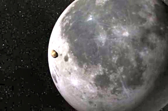
An artist's illustration of an 880-lb. space rock just before it slammed into the moon on Sept. 11, 2013 to create the brightest lunar impact flash ever seen. The meteorite impact carved a crater in the lunar surface 131 feet wide. (J. Madiedo /MIDAS/Universidad de Huelva

The March full moon will rise on Sunday night (March 16) in a brilliant display that will allow Internet denizens to investigate the site of the most brilliant lunar explosion in a free live webcast, weather permitting.

This month's full moon -- which officially turns full at 1:08 p.m. EDT (1708 GMT) Sunday -- is called the "Full Worm Moon." The seemingly odd name comes from the appearance of earthworms as the ground softens after winter thaws. The online Slooh community telescope website will use the full moon event to examine an impact site in the Mare Nubium lunar basin. The webcast begins at 9 p.m. EDT (0100 March 17 GMT). You can view it directly through the Slooh website, or watch the full moon webcast live on Space.com.

The target of Sunday's Slooh lunar webcast is a region of Mare Nubium, where brightest asteroid strike on the moon ever seen was spoted last year. The asteroid was traveling at about 37,900 mph when it slammed into the moon, creating a crater about 131 feet wide on Sept. 11, 2013. Scientists announced the discovery on Feb. 24 of this year.

Scientists estimate that the asteroid was between 2 and 4.5 feet across. If an observer on Earth has been looking up at the moon during impact, they may have seen a long flash almost as bright as the North Star Polaris, brighter than any lunar impact recorded. [See a video of the bright lunar impact]

If a space rock of the size of the lunar hit struck the Earth, it would likely create an amazing fireball in the sky, but it would pose no threat to people on the ground, researchers have said. The impact was so spectacular on the moon because the natural satellite's extremely thin atmosphere (called an exosphere) does not protect the lunar surface from strikes like this one. "Ever since Luis and Walter Alvarez astonished the world in 1980 by presenting convincing evidence that an asteroid impacted our planet and wiped out the dinosaurs 65 million years ago, the threat of an Earth-altering collision has remained in the public awareness," Slooh astronomer Bob Berman said in a statement. "The astonishing double-whammy of Feb. 15, 2013, when an asteroid near miss occurred on the same day that an asteroid fragment exploded over Siberia, injuring 1,500 people, underscores the reality of thousands of uncharted asteroid fragments that can cross our path at any time. In the past year, Slooh has managed to track and image several of these in real-time, and displayed these encounters to the public as they happened."

Sunday night's full moon is not only known as the Full Worm Moon. It also carries the name "Full Crow Moon" for the cawing crows that signal the end of winter, and the "Full Crust Moon" for the crusted snow created by repeated thawing and freezing.

Editor's note: If you take an amazing photo or video of the March full moon, or any other night sky view, and would like to share it with Space.com for a story of image gallery, send images and comments to managing editor Tariq Malik at: spacephotos@space.com.

Follow Miriam Kramer @mirikramer and Google+. Follow us @Spacedotcom, Facebook and Google+. Original article on Space.com.
Copyright 2014 SPACE.com, a TechMediaNetwork company. All rights reserved. This material may not be published, broadcast, rewritten or redistributed.

RELATED ON SKYE: 20 Epic Photos of Astronauts on the Moon
Man on Moon


Permalink | Email this | Linking Blogs | Comments

Snowstorm Set to Sweep from St. Louis to DC

$
0
0
Saturday, March 15, 2014


Spring officially starts on Thursday, but Mother Nature will bring another blast of winter weather from Missouri to Delaware before the seasons change.

A winter full of nasty snow and ice will not end quietly as a gathering storm across the southern Plains on Saturday slides east and collides with a fresh cold air mass on Sunday into Monday.

While the focus initially will be on severe weather, a wintry mess will quickly unfold into Monday.
As yet another push of cold air drives southward across the Midwest and Great Lakes, moisture will surge northward. A swath of snow and sleet is expected to develop from Missouri eastward along the Ohio River on Sunday.

While the precipitation may start as a brief period of rain, the arrival of cold air should allow the majority of the precipitation to fall as snow or sleet in cities such as Springfield and St. Louis, Mo., Louisville, Ky., and Cincinnati, Ohio.

East of the Appalachians, the most treacherous conditions are expected on Sunday night through the morning commute on Monday as temperatures fall below freezing.

Snow and ice should extend along the Ohio River and then across the Mason-Dixon Line by Monday morning and even reach places as far south as the North Carolina/Virginia border.

Most places in this band can expect enough snow to shovel with some spots in the mountains of West Virginia and Virginia picking up around a half foot of fresh snow.

Since much of the snow is forecast to fall at night in locations such as Philadelphia, Pa., Baltimore, Md., Washington, D.C., and Charleston, W.Va., roads can quickly become slick and snow covered. Conditions for Monday morning's commute will be poor.

RELATED:
AccuWeather.com Winter Weather Center
Severe Storms Threaten Texas to Georgia
AccuWeather.com Severe Weather Center


Fortunately, a combination of a higher sun angle in March and temperatures climbing above freezing on Monday afternoon will allow for improving conditions.

Farther north, snow may graze New York City for the St. Patrick's Day parade on Monday morning. The cold, dry air centered over the Northeast is expected to keep the heaviest snow south of the region.

This latest storm comes just days after a taste of spring arrived in the mid-Atlantic and Ohio River Valley. Temperatures reached into the 70s from North Carolina to Maryland last week.

"It's the typical roller-coaster ride of March," AccuWeather.com Senior Meteorologist Dave Dombek said. "March is notorious for huge temperature swings."

In the wake of the winter weather, milder weather will return by Wednesday.

RELATED ON SKYE: The World's Most Pathetic Snowmen


Permalink | Email this | Linking Blogs | Comments

Severe Storm, Tornado Threat to Spike Later Than Usual in 2014

$
0
0
Saturday, March 15, 2014

This file photo the western Illinois town of Washington shows the destruction left in the wake of a powerful tornado. (AP Photo/Charles Rex Arbogast, File)

Persistent cold air during the first part of the spring is likely to cause severe weather to get off to a sluggish start in a heavily populated part of the nation. However, a marked turnaround is expected later in the spring for 2014.

On average, severe weather gradually ramps up moving forward through the spring. This year, the transition may occur later and may be more dramatic.

A spike in damaging thunderstorms, including some capable of producing tornadoes, is expected during May and June.

Early Season Temperature Extremes

According to AccuWeather Long Range Weather Expert Paul Pastelok, "We expect a southward dip in steering-level winds to occur much of the time over a large part of the Midwest to the Eastern states during March and the first part of April."

This dip of strong winds high in the atmosphere, known as a jet stream trough, will generally keep warm, moist air at bay from near the Mississippi River to the Atlantic coast.


Last year, a similar setup occurred in much of the same area during the spring and led to a much lower-than-average severe weather season for the nation as a whole.

Thunderstorms are fueled by rising warm, moist air. As a general rule, the lower the temperature near the ground, the lower the risk for tornadoes and violent thunderstorms.

"This year, the ground is colder, the Great Lakes have an extensive amount of ice and the Gulf of Mexico waters are starting off colder than average," Pastelok said. "All of these can have a negative impact on temperatures in the lower atmosphere."

Over much of the Southeast, Midwest and Northeast, the tornado risk will be lower than average early on due to the colder-than-average environment expected.

RELATED:
AccuWeather Severe Weather Center
The Difference Between Tornado Watches and Warnings
Spring Severe Storm Season in 2014 May Be Similar to 2013


According to Severe Weather Expert Dan Kottlowski, "As a positive note, we may not see the frequency and violence of severe thunderstorms and tornadoes that typically occur during March and much of April, because of the lingering chill impacting a significant part of the nation."

However, Kottlowski urged caution when comparing overall numbers of tornado and other severe weather incidents to other seasons.

"This is not to say there cannot be a couple of outbreaks of severe weather during the first part of the spring in portions of the Midwest, the South and even the Northeast," Kottlowski said. "People should not let their guard down."

Even during a minor severe weather event, all it takes is one tornado hitting a populated area to bring the potential for great loss of life and destruction.

Strong storm systems can exploit temperature extremes. These storms can allow building warm, moist air to surge in just long enough to trigger an outbreak of severe weather in an otherwise, predominately cool weather pattern.

There is one area where severe weather may get off to an early, typical start with the possibility of frequent severe weather events during March and April.

In portions of Texas, Oklahoma, western Arkansas and western Louisiana, Kottlowski and Pastelok both expect warmth to build quickly relative to the balance of the Central and Eastern states.

The AccuWeather long-range team has concerns for flooding over part of the Tennessee and Ohio valleys with this setup, however. Weakening thunderstorms could unload heavy rain as they move farther east and unwind in the semi-permanent cooler air.

Dramatic Pattern Change Later in Spring

Pastelok and Kottlowski expect the pattern from the Mississippi Valley to the East to change significantly during May and June and correspondingly expect a spike in severe weather incidents to progress northward and eastward.


"We expect a normal to perhaps an above-average amount of severe thunderstorms over the Central states during May and June," Kottlowski said.

Indications are that the jet stream will pull to the north during May and June and hence will allow warm, moist air to flow northward more regularly over the Midwest.

"While warmth combined with drier air may keep a lid on severe weather for a time in the East during May, the air should be thoroughly warm and moist over much of the Midwest and South Central states," Pastelok said.

Areas from the Dakotas and Minnesota to Wisconsin, Michigan, the Appalachians and Atlantic coast should experience surge of severe weather during June and July.

A significant number of severe weather events are likely to continue to occur over the balance of the Midwest and South Central states and expand to along the Rockies as spring draws to a close and summer begins.

RELATED ON SKYE: 50 Must-See Weather Photos
Lightning Hits the Grand Canyon


Permalink | Email this | Linking Blogs | Comments

Viewing all 4069 articles
Browse latest View live


Latest Images