Quantcast
Channel: SKYE on AOL
Viewing all 4069 articles
Browse latest View live

Thousands Without Power During 'Historic, Life-Threatening Cold'

$
0
0

Tuesday, Jan. 7, 2014
Deep Freeze
A man braves subzero cold as he walks down a street in downtown Indianapolis on Monday, Jan. 6, 2014, following a powerful snowstorm that dumped more than a foot of snow on parts of Indiana. (AP Photo/Rick Callahan)

Many locations in the eastern portion of the country are still under a wind chill advisory or warning as of early Tuesday morning with wind chill values as low as 30 to 50 below zero.

Wind chills lower than minus 50 degrees Fahrenheit can cause exposed flesh to freeze in only five minutes.

The National Weather Service has referred to the cold outbreak as 'historic and life-threatening', as temperatures near all-time cold records highs.

Thousands remain without power in the areas hit hardest by the storm.

In Indianapolis, more than 12,000 customers remained without power prior to sunrise Tuesday morning.

A press conference was held at 11:15 a.m. EST Monday, by the Indiana State Police, Department of Transportation, Governor Mike Pence and Indiana National Guard to address the winter conditions.

More than 27 counties in Indiana were declared under a state of emergency Monday afternoon.

Meanwhile, emergency response continues in Illinois, where RealFeel(R) temperatures are hovering between minus 20 and minus 35 degrees Fahrenheit.

In anticipation of the winter weather in Illinois, the state has extended hours of operation for more than 100 warming centers, six of which are located in Chicago. The centers are open to anyone in need of refuge from the frigid weather.

On Sunday, more than 11 inches of snow fell in Chicago, slowing road travel, and canceling thousands of flights.

The severe winter conditions prompted a press release from Illinois Governor Pat Quinn on Monday.

"As we continue to monitor weather conditions and work nonstop to respond to this winter storm, we will ensure that critical state services continue," said Governor Quinn.

"To protect the safety of our employees and the people they serve, I am directing state employees whose duties are not critical to state services to stay home and off the roads on Monday."

Though the snow has stopped in Illinois, the state continues to face "a dangerous combination of low temps, black ice, & drifting snow," Quinn tweeted.

PHOTOS ON SKYE: Dangerous Deep Freeze Pummels Much of US


Read | Permalink | Email this | Linking Blogs | Comments


Polar Air Freezes the Eastern and Southern US

$
0
0
Updated Tuesday, Jan. 7, 2014, 5:50 p.m. ET
CHICAGO, IL - JANUARY 06:  Ice builds up along Lake Michigan at North Avenue Beach as temperatures dipped well below zero on January 6, 2014 in Chicago, Illinois. Chicago hit a record low of  -16 degree Fahrenheit this morning as a polar air mass brought the coldest temperatures in about two decades into the city.  (Photo by Scott Olson/Getty Images)
Ice builds up along Lake Michigan at North Avenue Beach as temperatures dipped well below zero on January 6, 2014 in Chicago, Illinois. (Photo by Scott Olson/Getty Images)

ATLANTA (AP) - The polar air that has made the Midwestern United States shiver over the past few days spread to the East and South on Tuesday, setting record low temperatures from Boston and New York to Atlanta, Birmingham, Nashville and Little Rock - places where many people don't know the first thing about extreme cold.

The Midwest and the East were colder than much of Antarctica.

In a phenomenon that forecasters said is actually not all that unusual, all 50 states saw freezing temperatures at some point Tuesday. That included Hawaii, where it was 18 degrees (-8 Celsius) atop Mauna Kea, a dormant volcano.

PHOTOS ON SKYE: Dangerous Deep Freeze Pummels Much of US
The big chill started in the Midwest over the weekend, and by Tuesday, it covered about half of the country. In New York City, the high was expected to be 10 degrees (-12 Celsius); in Boston, around 18 degrees (-8 Celsius).

Across the South, records were shattered like icicles. Birmingham, Alabama, dipped to a low of 7 degrees (-14 Celsius), breaking the record of 11 degrees (-11.7 Celsius) set in 1970. Atlanta saw a record low of 6 degrees (-14.5 Celsius). Nashville, Tennessee, got down to 2 degrees (-16.7 Celsius), and Little Rock, Arkansas, fell to 9 degrees (-13 Celsius). It was just 1 degree (-17 Celsius) at Washington Dulles International airport, eclipsing the 1988 mark of 8 degrees (-13 Celsius).

The deep freeze dragged on in the Midwest as well, with the thermometer reaching minus 12 (-24 Celsius) overnight in the Chicago area and 14 below (-25.5 Celsius) in suburban St. Louis. More than 500 passengers were stranded overnight on three Chicago-bound trains that were stopped by blowing and drifting snow in Illinois. Food ran low, but the heat stayed on.

The worst should be over in the next day or two. Warmer weather - at least, near or above freezing - is in the forecast for much of the stricken part of the country.

On Tuesday, many schools and day care centers across the eastern half of the U.S. were closed so that youngsters wouldn't be exposed to the dangerous cold. Officials opened shelters for the homeless and anyone else who needed a warm place.

With the bitter cold slowing baggage handling and aircraft refueling, airlines canceled more than 2,000 flights in the U.S., bringing the four-day total to more than 11,000.

In New Orleans, which reported a low of 26 degrees (-3 Celsius), hardware stores ran out of pipe insulation. A pipe burst in an Atlanta suburb and a main road quickly froze over. In downtown Atlanta, a Ferris wheel near Centennial Olympic Park that opened over the summer to give riders a bird's eye view of the city closed because it was too cold.

Farther south in Pensacola, Florida, a Gulf Coast city better known for its white sand beaches than frost, streets normally filled with joggers, bikers and people walking dogs were deserted early Tuesday. A sign on a bank flashed 19 degrees (-7 Celsius). Patches of ice sparkled in parking lots where puddles froze overnight.

The continental U.S., when averaged out, reached a low of 13.8 degrees (-10 Celsius) overnight Monday, according to calculations by Ryan Maue of Weather Bell Analytics. An estimated 190 million people in the U.S. were subjected to the icy blast, caused by a kink in the "polar vortex," the strong winds that surround the North Pole.

In Chicago, it was too cold even for the polar bear at the Lincoln Park Zoo. While polar bears can handle below freezing cold in the wild, Anana was kept inside Monday because she doesn't have the thick layer of fat that bears typically get from feeding on seals and whale carcasses.

PHOTOS ON SKYE: Dangerous Deep Freeze Pummels Much of US
Deep Freeze


Permalink | Email this | Linking Blogs | Comments

Travelers Spend Night Stranded on 3 Snowbound Amtrak Trains

$
0
0
Updated Tuesday, Jan. 7, 2013, 11:34 a.m. ET
Winter Weather
An Amtrak train kicks up fresh snow as it speeds southbound on Friday, Jan. 3, 2014, in Schodack Landing, N.Y. (AP Photo/Mike Groll)

CHICAGO (AP) - Hundreds of Amtrak passengers who spent the night onboard three trains stranded in snow in northern Illinois have begun to arrive in Chicago, rail line officials said Tuesday morning.

About 300 passengers on two trains that were stuck near Mendota, about 80 miles from Chicago, boarded buses in Princeton for the final leg of their trip, said Amtrak spokesman Marc Magliari. They began arriving in downtown Chicago around 7 a.m. Tuesday and more were expected to arrive throughout the morning.

PHOTOS ON SKYE: Dangerous Deep Freeze Pummels Much of US
Deep Freeze MississippiA third train loaded with 217 people spent the night at a BNSF rail yard in Galesburg; they were taking buses for the final 150 miles to Chicago.

The trains - the Southwest Chief from Los Angeles, the Illinois Zephyr from Quincy and the California Zephyr from the San Francisco Bay area - got stuck after 3 p.m. Monday in blowing, drifting snow and ice that Magliari said made the tracks impassable.

Several passengers speaking to news outlets by cellphone said conditions on the trains deteriorated and that they went long periods without food.

"The conditions is cold; we're wearing coats. And my husband is a diabetic. He hasn't had any food all day," Laurette Mosley told ABC News. "The bathrooms are flooded. The sinks are full with water and the toilets are flooded."

Mosely was traveling from California to Chicago to attend her mother's funeral.

Magliari said emergency workers were on standby, and that train crews handed out food and prepared for any medical issues, though he said there were none. He said the bathrooms on board the trains were working.

"There was no good reason to take people out of warm trains ... into the cold," he said. "We sheltered them in place."

Another passenger, Bryan Plummer, told ABC News that they were given dinner but no snacks during the 15 hours they were stranded.

"I inquired about breakfast service and they stated that at this time there was none planned. When the sheriff's officer that was on board here, when he left around 3 a.m. this morning, he stated that the Red Cross was involved and was trying to get us some meals," Plummer told ABC.

Amtrak canceled nearly two dozen trains in Illinois on Tuesday because of the cold and lingering snow from a weekend storm that dumped more than a foot of snow in some areas of Illinois.

Magliari said crews were clearing tracks and hoped to resume operations Wednesday.

PHOTOS ON SKYE: Dangerous Deep Freeze Pummels Much of US
Chicago Deep Freeze


Permalink | Email this | Linking Blogs | Comments

UK Hit by High Winds After Month of Wintry Weather

$
0
0
Tuesday, Jan. 7, 2014
Britain Northern Ireland Weather
Large waves crash onto the road in the coastal village of Carnlough, Northern Ireland, Friday, Jan. 3, 2014. (AP Photo/Peter Morrison)

LONDON (AP) - Britain's western coast is being lashed by high winds and strong rains following a month of unusually frequent winter storms.

A steady procession of storms has battered the island nation over the past few weeks, making December the windiest since 1969. Monster waves up to 27 feet (8.3 meters) high washed across the British coast on Monday, prompting evacuations and rescues.

The nearly non-stop storms have crumbled long-standing sea cliffs and damaged waterfronts.

"It's been one after the other with no break," Nicola Maxey, a spokeswoman for Britain's Meteorological Office, said Tuesday.

More than 100 flood warnings remain across England and Wales.

Heavy winds and rain have also battered the French coast, driving large waves into southwestern town of Biarritz on Tuesday.

RELATED ON SKYE: 50 Incredible Photos of Forces of Nature
Volcano Eruption


Permalink | Email this | Linking Blogs | Comments

Watch: Polar Vortex Causes 'Steam Devil' on Lake Michigan

$
0
0
Cold Front Causes Steam Devil
An Arctic vortex drifted into Illinois on January 6 and caused an unusual sight - steam rising from Lake Michigan. This phenomenon is known as a steam devil, and it is due to the cold front of the vortex moving over the warmer water and humidifying, causing the visible steam.

RELATED ON SKYE: 30 Ice Sculptures That Will Take Your Breath Away


Permalink | Email this | Linking Blogs | Comments

Photos: Massive Waves Pummel Europe

Snowy Owl Invasion Puzzles Scientists, Dazzles Enthusiasts

$
0
0


Snowy owls have been spotted in the Northeast U.S., all the way down to South Carolina, since early December.

Scientists aren't sure why the owls, who spent much of their lives around the Arctic Circle, have arrived in such large numbers.

"It's a great opportunity to see a magnificent animal," Kevin McGowan of Cornell University's Lab of Ornithology in Ithaca, N.Y., said.

The owls, the largest in North America, do make forays into the Northeast but this year is different, McGowan said.

"Here in central New York, there were 10 sightings in 10 days," he said. "This is just not the normal way of things."

Snowy owls normally hunt for food at night by hovering in the area or watching from their perches.

There are two conceivable possibilities for the irruption, or rapid and irregular, increase of owls.

"One is that they have a very high success rate in breeding this year over last year. The parents tend to jostle them out of the nest," McGowan said. "The opposite possibility is that the normal food sources are disrupted and they have to travel farther south to find their food.

"Either way, there are a lot more of them. They're just impressive. It's really cool."

It's unclear whether climate change is playing a role in this year's owl display.

"We just don't know," McGowan said. "It is a rather fragile ecosystem. They are adapted to spend the winter at the North Pole."

Snowy owls normally spend the winter on the pack ice and hang around the holes, waiting to a seabird meal. They also look for lemmings in the snow.

If the ice was more open, there may be more seabirds and hunting is more efficient, McGowan said. It could also mean the food source is more spread out and the owls are unable to find enough to eat.

More snow in the region may mean the lemmings are harder to find.

Two things are clear: There are less ice and more stormy conditions in the Hudson Strait between Baffin Island and the northern coast of Quebec, AccuWeather.com expert senior meteorologist Brett Anderson said.

RELATED:
Detailed Seattle Forecast
Cold Weather Advisories, Warnings
Polar Vortex, Arctic Air to Leave US

"The trend has been for less ice in the Hudson Strait, especially since the 1990s," Anderson said.

Stormier conditions make sense for the owls' movement, Anderson said.

"It has been warmer. That means more moisture is available. Storms can get more extreme."

People can post snowy owl sightings to Cornell's eBird website or to the ongoing Audubon Christmas Bird Count.

This map from Cornell's eBird website shows the reported sightings of snowy owls in the eastern and southern U.S. since the beginning of December.

RELATED ON SKYE: The Arctic Fox and More Amazing Cold Weather Creatures


Read | Permalink | Email this | Linking Blogs | Comments

Heavy Rain, Fierce Winds Heading for the Northwest

$
0
0

Wednesday, Jan. 8, 2014
Vehicle on snowy forest road
(Shutterstock)

Waves of rain and snow are forecast for the Northwest into this weak, but a powerful system promises to add fierce winds to the mix by Saturday.

Winds on the ridge tops of the Cascades, Bitterroots and northern Rockies will easily blow in excess of 80 mph with gusts over 100 mph.

These winds will get funneled through some of the passes and create hazardous driving conditions, especially those oriented west to east or southwest to northeast.

The powerful winds will rush down the lee of the Cascades and Rockies and create wind gusts in excess of 75 mph. Chinook winds can locally gust in excess of 100 mph in northern Montana, specifically along U.S. Highway 2 just east of Glacier National Park.

The howling winds will impact drivers on Interstates 15, 90, 84 and 25. High profile vehicles such as RV's and tractor trailers will be especially vulnerable to powerful crosswinds on north to south roads.

The winds can also down trees and power lines and create power outages.

Rain will be heavy at times across western Washington and Oregon. The greatest amount of rain will be found in the Foothills of the Cascades and along the coast, where rainfall amounts on Friday through Saturday can exceed 4 inches.

There is a risk of localized flooding in some low lying and poor drainage areas.

Folks in Seattle, Wash., and Portland, Ore., can see downpours at times on Friday into Saturday along with wind gusts to 40 mph.

Snow levels on Friday will be at 3,000-4,000 feet, then rise to around 6,000 feet on Saturday. There can be some snow accumulation in the higher passes which can cause slippery roads.

RELATED:
Detailed Seattle Forecast
Cold Weather Advisories, Warnings
Polar Vortex, Arctic Air to Leave US

Unfortunately for drought-stricken California, this storm will pass to the north and fail to give the state some much-needed rainfall.

Strong winds will spread into the northern Plains later on Saturday and into Sunday with gusts topping 50 mph.


RELATED ON SKYE: 20 Photos of Monster Blizzards


Read | Permalink | Email this | Linking Blogs | Comments


Arctic Air Eases Its Grip on Much of the US

$
0
0
Wednesday, Jan. 8, 2014
Garret Kelenske, 49, works to remove snow on the sidewalk along Hoyt Street near Sacred Heart Church in Muskegon Heights, Mich., Tuesday, Jan. 7, 2014. He is the facility maintenance manager for the church and surrounding buildings which take up a city block. (AP Photo/The Muskegon Chronicle, Ken Stevens)
Garret Kelenske, 49, works to remove snow on the sidewalk along Hoyt Street near Sacred Heart Church in Muskegon Heights, Mich., Tuesday, Jan. 7, 2014. (AP Photo/The Muskegon Chronicle, Ken Stevens)

ATLANTA (AP) - An arctic blast eased its grip on much of the U.S. on Wednesday, with winds calming and the weather warming slightly a day after temperature records - some more than a century old - shattered up and down the Eastern Seaboard.

In Atlanta, where a record low of 6 degrees Fahrenheit (-14 Celsius) hit early Tuesday, fountains froze over, a 200-foot (60-meter) Ferris wheel shut down and Southerners had to dig out winter coats, hats and gloves they almost never have to use. It shouldn't take too long to thaw out, though. The forecast Wednesday was sunny and 42 degrees (5 Celsius).

In the Midwest and East, where brutal polar air has lingered over the past few days, temperatures climbed but were still expected to be below freezing.

PHOTOS ON SKYE: Dangerous Deep Freeze Pummels Much of US
Deep Freeze Mississippi
In Indianapolis, Timolyn Johnson-Fitzgerald returned to her home after spending the night in a shelter with her three children because they lost power to their apartment. The water lines were working, but much of the food she bought in preparation for the storm was ruined from a combination of thawing and then freezing during the outage.

"All my eggs were cracked, the cheese and milk was frozen. And the ice cream had melted and then refroze. It's crazy, but we're just glad to be back home," she said.

On Tuesday, the mercury plunged into the single digits and teens from Boston and New York to Atlanta, Birmingham, Nashville and Little Rock - places where many people don't know the first thing about extreme cold.

"I didn't think the South got this cold," said Marty Williams, a homeless man, originally from Chicago, who took shelter at a church in Atlanta. "That was the main reason for me to come down from up North, from the cold, to get away from all that stuff."

The cold turned deadly for some: Authorities reported at least 21 cold-related deaths across the country since Sunday, including seven in Illinois and six in Indiana. At least five people died after collapsing while shoveling snow, while several victims were identified as homeless people who either refused shelter or didn't make it to a warm haven soon enough.

In Missouri on Monday, a 1-year-old boy was killed when the car he was riding in struck a snow plow, and a 20-year-old woman was killed in a separate crash after her car slid on ice and into the path of a tractor-trailer.

In a phenomenon that forecasters said is actually not all that unusual, all 50 states saw freezing temperatures at some point Tuesday. That included Hawaii, where it was 18 degrees (-8 Celsius) atop Mauna Kea, a dormant volcano.

It was 1 degree (-17 Celsius) in Reading, Pa., and 2 (-17 Celsius) in Trenton, New Jersey. New York City plummeted to 4 degrees (-15 Celsius); the old record for the date was 6 (-14 Celsius), set in 1896.

"It's brutal out here," said Spunkiy Jon, who took a break from her sanitation job in New York to smoke a cigarette in the cab of a garbage truck. "Your fingers freeze off after three minutes, your cheeks feel as if you're going to get windburn, and you work as quick as you can."

Farther south, Birmingham, Alabama, dipped to a low of 7 (-14 Celsius), four degrees colder than the old mark, set in 1970.

The big chill started in the Midwest over the weekend, caused by a kink in the "polar vortex," the strong winds that circulate around the North Pole. The icy air covered about half the country by Tuesday, but it was moving north, returning more normal and warmer weather to most of the country.

The deep freeze dragged on in the Midwest. More than 500 Amtrak passengers were stranded overnight on three Chicago-bound trains that were stopped by blowing and drifting snow in Illinois. Food ran low, but the heat stayed on.

On Tuesday, many schools and day care centers across the eastern half of the U.S. were closed and officials opened shelters for the homeless and anyone else who needed a warm place.

With the bitter cold slowing baggage handling and aircraft refueling, airlines canceled more than 2,000 flights in the U.S., bringing the four-day total to more than 11,000.

The Lower 48 states, when averaged out, reached a low of 13.8 degrees (-10.1 Celsius) overnight Monday, according to calculations by Ryan Maue of Weather Bell Analytics. An estimated 190 million people in the U.S. were subjected to the polar vortex's icy blast.

PJM Interconnection, which operates the power grid that serves more than 61 million people in the Mid-Atlantic, Midwest and South, asked users to conserve electricity because of the cold, especially in the morning and late afternoon.

Across the South, the Tennessee Valley Authority said power demand in the morning reached the second-highest winter peak in the history of the Depression-era utility.

In South Carolina, a large utility used 15-minute rolling blackouts to handle demand, but there were no reports of widespread outages in the South.

Natural gas demand in the U.S. set a record Tuesday, eclipsing the mark set a day earlier, according to Jack Weixel, director of energy analysis at Bentek Energy.

PHOTOS ON SKYE: Dangerous Deep Freeze Pummels Much of US
Chicago Deep Freeze


Permalink | Email this | Linking Blogs | Comments

Vail Founder's Grandson Killed in Colorado Avalanche

$
0
0
Wednesday, Jan. 8, 2014
This photo provided by the Eagle County (Colo.) Sheriff's Office, one person was killed and three injured in an avalanche on Tuesday, Jan. 7, 2014, in the East Vail Chutes in the back country outside of Vail Mountainís ski boundary near Vail, Colo.  (AP Photo/Eagle County Sheriff)
One person was killed and three injured in an avalanche on Tuesday, Jan. 7, 2014, in the East Vail Chutes in the back country outside of Vail Mountain's ski boundary near Vail, Colo. (AP Photo/Eagle County Sheriff)

VAIL, Colo. (AP) - The grandson of Vail's founder was killed and three other people were injured Tuesday in an avalanche near the ski resort, authorities said.

Anthony Seibert, 24, was killed in the slide in the backcountry near Vail, Eagle County coroner Kara Bettis said. She said Seibert is the grandson of Peter Seibert, who along with Earl Eaton is widely credited with finding the terrain that would later become Vail Mountain.

The three others who were injured were expected to recover from their injuries. Their names weren't released.

Sheriff's spokeswoman Jessie Mosher said the slide happened at around 11:30 a.m. in East Vail Chutes, an area between Vail Mountain and Vail Pass.

The death is the fifth in the Rocky Mountain region and the second in Colorado in the last two weeks.

The avalanche danger where the latest deadly slide occurred is rated as considerable at or above the tree line for two main reasons. New snow over the weekend was pushed into slabs by wind, and those more cohesive layers of snow are resting on top of the relatively weak early season snowfall, said Spencer Logan of the Colorado Avalanche Information Center. The combination of a weak base layer under cohesive slabs tends to create slides that break in very wide pieces.

Such dangerous conditions are possible each winter, but last year they didn't develop until late January because significant snowfall didn't develop until later in the season, Logan said.

East Vail Chutes has had a series of slides in the last few weeks, including one that trapped a skier. A popular YouTube video shows Edwin LaMair trapped up to his neck before his brother and a friend dug him out.

RELATED ON SKYE: 20 Photos of Monster Blizzards


Permalink | Email this | Linking Blogs | Comments

By the Numbers: Temperatures Plummet to Brutal Extremes in US

$
0
0
Wednesday, Jan. 8, 2014
Polar Vortex drops over United States and Canada
People bundled up in their coats walk outside in New York City, January 7, 2014, as a polar vortex grips United States and Canada. (Photo by Bilgin Sasmaz/Anadolu Agency/Getty Images)

Long-standing records were shattered across the East and South on Tuesday morning, as the coldest air in 20 years arrived.

An unusual positioning of the polar vortex is the culprit behind the dangerous cold. The polar vortex is a large pocket of very cold air, which sits over the polar region during the winter season, and it has shifted unusually far south into the U.S.

AccuWeather RealFeel(R) temperatures have been even lower than actual temperatures due to icy winds and seven additional parameters taken into account by this unique index. It is one of a kind because AccuWeather is the only company that can use more than two elements in its equation, because it is patented. Additional factors, such as humidity and sun angle, can make a big difference in how cold it feels outside.

Commuters exit Union Station with AccuWeather RealFeels(R) below 30 degrees below zero F on Tuesday, Jan. 7, 2014, in downtown Chicago. (AP Photo/Andrew A. Nelles)

RELATED:
What is the AccuWeather RealFeel Temperature?
The Bizarre Effects of Hypothermia
What is a Polar Vortex?


The cold was extreme enough to close schools, threaten frozen pipes and cause significant flight delays.

Atlanta Public Schools were closed for the safety of students and employees on Tuesday as the temperature plunged into the single digits in the morning. An emergency shelter was opened by theCity of Atlanta to provide warmth and cots for residents as the unusual cold arrived.

Numerous record lows fell as the cold gripped the region on Tuesday, and some were records set more than 100 years ago.

"Philly and Atlanta recorded their first January record lows in the 21st century on Tuesday morning," AccuWeather senior meteorologist Alex Sosnowski said.

Highlights of Record Lows Shattered on Tuesday Morning

4 F in New York City's Central Park

The old record for the date was 6 F which was set back in 1896. The AccuWeather RealFeel(R) temperature fell to 20 below zero F Tuesday morning.

4 F in Philadelphia

The old record for the date was 7 F which was set in 1988. The AccuWeather RealFeel(R) temperature reached as low as 25 below zero F Tuesday morning.

13 below zero F in Dubois, Pa.

The old record for the date was 5 below zero F which was set in 1988. The AccuWeather RealFeel(R) temperature plunged to 45 below zero F Tuesday morning.

8 below zero F in Zanesville, Ohio

The old record for the date was 3 below zero F which was set in 1968. The AccuWeather RealFeel(R) temperature hit as low as 36 below zero F Tuesday morning.

6 F in Dover, Del.

The old record for the date was 10 F which was set in 1988. The AccuWeather RealFeel(R) temperature dropped to 24 below zero F Tuesday morning.

3 F in Baltimore

The old record for the date was 8 F which was set in 1988. The AccuWeather RealFeel(R) temperature was as low as 20 below zero F Tuesday morning.

10 F in Richmond, Va.

The old record for the date was 12 F which was set in 1988. The AccuWeather RealFeel(R) temperature reached 12 below zero F Tuesday morning.

9 F in Raleigh, N.C.

The old record for the date was 15 F which was set in 1988. The AccuWeather RealFeel(R) temperature was as low as 10 below zero F Tuesday morning.

7 below zero F in Morgantown, W.Va.

The old record for the date was 4 below zero F which was set in 1970. The AccuWeather RealFeel(R) temperature dropped below 25 below zero F.

7 F in Charlotte, N.C.

The old record for the date was 12 F which was set back in 1884. The AccuWeather RealFeel(R) temperature was as low as 2 below zero F early Tuesday morning.

13 F in Columbia, S.C.

The old record for the date was 16 F which was set back in 1924. The AccuWeather RealFeel(R) temperature plummeted to 5 F Tuesday morning.

6 F in Atlanta

The old record for the date was 10 F which was set back in 1970. The AccuWeather RealFeel(R) temperature bottomed out at 11 below zero F Tuesday morning.

7 F in Birmingham, Ala.

The old record for the date was 11 F which was set back in 1970. The AccuWeather RealFeel(R) temperature hit as low as 4 below zero F Tuesday morning.

PHOTOS ON SKYE: Dangerous Deep Freeze Pummels Much of US
Chicago Deep Freeze


Permalink | Email this | Linking Blogs | Comments

Watch: Sun Unleashes 1st Major Solar Flare of 2014

$
0
0
Wednesday, Jan. 8, 2013Solar Flare

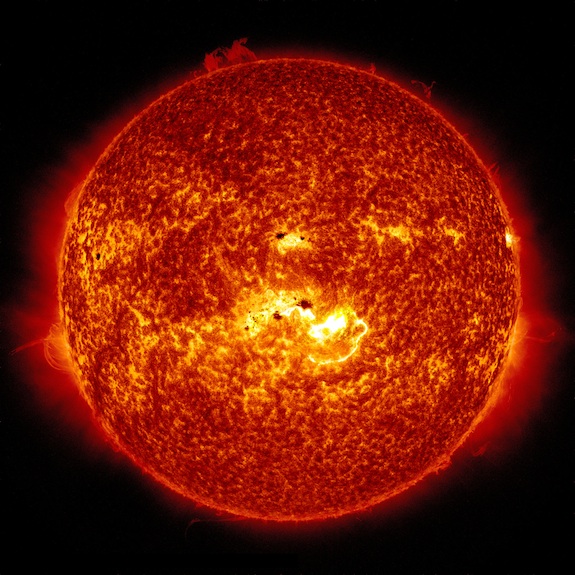
A massive solar flare erupted from the sun on Tuesday (Jan. 7), rising up from what appears to be one of the largest sunspot groups seen on the star's surface in a decade, NASA officials say.

NASA's Solar Dynamics Observatory captured a video of the huge solar flare as it developed, showing it as an intense burst of radiation from a colossal sunspot region known as AR1944. The sunspot group - which is currently in the middle of the sun as viewed from Earth - is "one of the largest sunspots seen in the last 10 years," NASA officials wrote in a statement. It is as wide as seven Earths, they added.


Tuesday's big flare was an X1.2-class solar event on the scale used to classify sun storms. It occurred at 1:32 p.m. EST (1832 GMT) and came just hours after an M7.2-class flare. Space weather officials at the the Space Weather Prediction Center overseen by NOAA are expecting the flare to spark geomagnetic storms in Earth's magnetic field when a wave of super-hot solar plasma associated with the flare - known as a coronal mass ejection - reaches Earth in the next few days. [Photos: The Biggest Solar Flares of 2014]

"This is the first significant flare of 2014, and follows on the heels of mid-level flare earlier in the day," NASA spokeswoman Karen Fox of the agency's Goddard Space Flight Center in Greenbelt, Md., wrote in a statement. "Each flare was centered over a different area of a large sunspot group currently situated at the center of the sun, about half way through its 14-day journey across the front of the disk along with the rotation of the sun."

X-class solar flares are the most powerful solar storms on the sun. Mid-level storms are dubbed M-class events and can supercharge Earth's northern lights displays, with weaker C-class flares rounding out the top three.

When aimed directly at Earth, the strongest X-class solar flares can pose a risk to astronauts in orbit and interrupt communications and navigation satellite operations.

Tuesday's solar flare did force the commercial spaceflight company Orbital Sciences to delay the launch of its first Cygnus cargo mission to the International Space Station from NASA's Wallops Flight Facility on Wallops Island, Va.

NASA officials told SPACE.com today that the crew of the International Space Station will not have to take measures to shelter themselves from the solar flare's radiation effects. There are currently six astronauts living on the station as part of the outpost's Expedition 38 crew. The team includes three Russian cosmonauts, two NASA astronauts and one Japanese astronaut.

The sun is currently in an active phase of its 11-year solar cycle. The current cycle, called Solar Cycle 24, began in 2008.

Update for 9:30 a.m. ET: Tuesday's massive solar flare has forced the commercial spaceflight company Orbital Sciences to postpone the planned launch of a private cargo mission to the International Space Station today. Read the full story here: Huge Solar Flare Delays Private Rocket Launch to Space Station

Email Tariq Malik at tmalik@space.com or follow him @tariqjmalik and Google+. Follow us @Spacedotcom, Facebook and Google+. Original article on SPACE.com.

Copyright 2014 SPACE.com, a TechMediaNetwork company. All rights reserved. This material may not be published, broadcast, rewritten or redistributed.

RELATED ON SKYE: The 50 Best Space Photos of 2013
Best Space Photos 2013


Permalink | Email this | Linking Blogs | Comments

Zoo Animals Get Iced Treats as Brazil Swelters

$
0
0
Wednesday, Jan. 8, 2014
Brazil Heat No Deep Freeze
A chimpanze named Paulinho eats a fruit popsicle at the city zoo in Rio de Janeiro Brazil, Wednesday, Jan. 8, 2014. (AP Photo/Silvia Izquierdo)

RIO DE JANEIRO (AP) - Sure, it's mind-bogglingly cold in the Northern Hemisphere. But the sweltering weather on the opposite end of the Earth has man and beast alike dreaming of ice.

Brazil is sizzling, and with the heat index sometimes soaring above 120 F, keepers at the Rio de Janeiro zoo are giving the animals ice pops to beat the heat.

Brazil Heat No Deep FreezeThe homemade treats come in various flavors. For the big cats, there are bloody, 66-pound (30-kilo) blocks of ice and raw meat. There are bucket-sized cornucopias of iced fruit for Ze Comeia, a brown bear rescued from a circus, and a supply of chilled bananas for Karla the elephant.

The simians' treats, strawberry or mango-flavored frozen yogurt pops on sticks, looked the most appealing to the crowds of human visitors who stood Wednesday in the blazing sun and 94-degree weather to gape at the apes.

"When I saw them eating them their ice creams, I asked my parents to get me one, too," said Damaris Pereira Dias, 11, as she licked a rapidly melting treat in Brazil's adored green corn flavor. "It made me really hungry to watch them."

The apes couldn't get enough. Paulinho the chimpanzee reached long, leathery fingers through the bars to snatch a strawberry-flavored treat from zookeeper Karla Cunha's hand, then gobbled it down. He then delicately handed the stick back through the bars - a trick he's learned wins another ice pop.

The felines were less polite. Simba the 14-year-old lion and Neto, a 10-year-old Siberian tiger, put sandpaper tongues and pointy canines to work on giant bloodsicles, using oversized paws to hold the slick blocks of iced meat in place. Simba growled as a photographer got too close, and the crowd of cellphone photo-snapping visitors recoiled.

Brazil Heat No Deep Freeze
Simba the lion licks frozen meat at the city zoo in Rio de Janeiro, Brazil, Wednesday, Jan. 8, 2014 (AP Photo/Silvia Izquierdo)

Ze Comeia the bear used his back paws to grasp a giant tutti-frutti ice block that he licked while bobbing on his back in a wading pool. While one zookeeper sprayed Koala the 45-year-old female elephant with a garden hose, another placed banana after banana into her mouth.

"This is their favorite time of day," said Cunha, the zoo's dietitian. "In addition to cooling the animals down on days like this where the heat is downright unbearable, it's also fun and keeps them active."

With just weak water misters and wading pools to provide the animals with relief, icy treats are added to the zoo's menu when temperatures hit the mid-80s, Cunha said.

Zookeepers have been handing out nearly 100 of the frozen snacks daily during the heat wave that has seen temperatures soar above the mid-90s for about 10 straight days. The apes alone consume around 70 of the snacks per day, with the fruit and yogurt-blends in highest demand.

"Frozen yogurt is very popular this year," said Cunha. "They just go crazy for it."

Even amid the nation's heat wave, Brazilian media has focused on the extreme cold in the north.

The Folha de S.Paulo newspaper reported Wednesday on how sun-worshipping Brazilians were surviving the U.S. freeze, including 27-year-old Renato Volpi, who used a hair dryer to thaw frozen water pipes in Chicago. Folha's New York-based columnist Marcos Goncalves described the clothes he was wearing for the cold, including the exotic item of long underwear. "I've never experienced temperatures so low," Goncalves wrote.

The heat wave extended to neighboring Argentina, where hundreds of dead fish floated in a lake in the capital of Buenos Aires. Catfish and shad were the most affected. Alejandro Perez, director of the 3 de Febrero Park where the dead fish were found floating, said the high temperatures had stolen oxygen from the water life.

Temperatures that have risen to more than 90 F in the Southern Hemisphere summer have also sparked street protests in Argentina over electricity outages.

Meteorologist Fabio Rocha of Brazil's federal weather service said the heat wave was not a mirror opposite and in no way related to the polar vortex punishing the U.S. and other northern nations.

"There has been a lack of cloud cover, especially in the southeastern parts of Brazil, exposing the area to more of the sun's rays and driving up maximum temperatures," Rocha said. "It's going to remain like this, probably until the weekend when there may be some rains."

Ze Comeia and the other zoo animals, as well as their human fans, would certainly welcome some rain.

"I'm sweating so much out here, and I don't even have fur," zoo visitor Karla Nunes, a 55-year-old retiree said, as she mopped her bow. "Imagine them, poor things!"

RELATED ON SKYE: 13 Animal Photos from Nat Geo's 2013 Traveler Photo Contest


Permalink | Email this | Linking Blogs | Comments

First Northern Lights Display of 2014 for US Peaks Thursday

$
0
0

Wednesday, Jan. 8, 2014
East Coast From Space
The Northern Lights are seen above the East Coast in this photo, taken Jan. 29, 2012, by one of the Expedition 30 crew members aboard the International Space Station. (NASA)

The first northern lights display of 2014 is on tap for the United States Wednesday night into Thursday morning.

A strong, Earth-facing coronal mass ejection, or CME, occurred Tuesday which set the stage for a bright display across the northern half of the U.S., according to Expert Meteorologist Mark Paquette.

The more directly a flare faces the Earth, the better the chances are for a strong aurora to be visible.

While the show is expected to be a strong one, cloud cover could put a damper on the visibility for some.

The Northeast should provide mostly clear skies throughout the event.

"Anyone in the suburbs of Boston, New York City, Baltimore, Washington, D.C., or Philadelphia has a chance at seeing this," Paquette said.

RELATED:
AccuWeather.com Astronomy Facebook
AccuWeather.com Northeast Regional Radar
Forecast Temperature Maps

Residents of the Midwest and northern Plains states will also see good conditions.

Cloudy skies are most threatening for those in the West, including the suburbs of Seattle, Portland, Ore., and Boise, Idaho.

Skygazers will also struggle to see through the clouds from northern Kansas to far western Pennsylvania.

Despite visibility issues, the weather is in favor of those hoping to get outside, as dangerously low temperatures are finally retreating from the Plains to the Northeast.

Northern Lights Viewing

RELATED ON SKYE: 20 Dazzling Photos of the Northern Lights
Photos of the Northern Lights


Read | Permalink | Email this | Linking Blogs | Comments

Unabating Winter Takes Bite Out of State, Local Budgets

$
0
0

Thursday, Jan. 9, 2014

Sanitation trucks outfitted with snow plows clear Fifth Avenue of snow, Friday, Jan. 3, 2014, in New York. New York City public schools were closed Friday after up to 7 inches of snow fell by morning in the first snowstorm of the winter. (AP Photo/John Minchillo)

A vigorous start to winter is chewing up state and municipal budgets across the Northeast and Midwest in the United States.

Many places last year had a mild start and a snow drought to start the winter of 2012-2013, but not this year.

It will remain active for road crews for at least the next 10 days. There are two chances of snow this week and one the following week, AccuWeather.com expert senior meteorologist Bob Smerbeck said.

"Thursday into Thursday night, a weak storm will push snow across the Ohio Valley and lower Great Lakes; it could be a couple of inches and, with enhancement, may push as far east as Philadelphia and New York City," Smerbeck said.

Another storm is possible over the weekend, but the area of potential impact is not yet set in stone.

The storm may impact the northern Plains into the Upper Midwest and Great Lakes, Smerbeck said.

Snowfall Totals for Northeast U.S. Cities (as of Jan. 8)

Rank
City
Snowfall (Inches)
1
Pittsburgh
30.0
2
Boston
26.8
3
Philadelphia
20.2
4
New York City
15.0

The snow created an earlier start for road crews, who use a variety of materials including salt brine, anti-skid and sand in their efforts to maintain highways.

"The start of this winter has been more active than last winter and more costly in terms of material, overtime and fuel consumption for snow and ice removal," spokeswoman Jennifer Post of the New York State Department of Transportation said.

"However, the 2012-2013 winter season had one of the milder starts that we have seen in the past decade, so it's not a good benchmark for trends."

Post said she didn't have specific numbers on how much has been spent so far this winter but did say January and February are historically the most active winter-weather months in New York.

"With those months ahead, it's too early to make any fiscal projections about this winter," Post said. "If the budget for snow and ice removal is exceeded, we will make adjustments to other programs to cover the additional expenses."

While not budget help, New York Gov. Andrew Cuomo did give crews aid before the Jan. 3, 2014, storm that hit the state.

Cuomo declared a state of emergency and closed Interstate 84, the New York State Thruway between Albany and New York City and the Long Island Expressway in Nassau and Suffolk counties.

"The highway restrictions allowed snow clearing operations on critical roadways to be maintained overnight while ensuring the safety of motorists and plow operators," Post said.

The advanced notice also encouraged motorists to stay off the roads during the height of the storm.

RELATED:
Snowstorm Survival Guide: These Tips Could Help Save Your Life
AccuWeather Winter Weather Center
Learn These Four Winter Driving Myths to Stay Safe in a Snowstorm

As of Dec. 26, Wisconsin had spent about $25 million for snow removal, Michael Sproul of the Wisconsin Department of Transportation's Bureau of Highway Maintenance said.

The state has $73.3 million budgeted for winter maintenance during the 2013-2014 fiscal year.

"At this same time last winter, which was the most costly winter on record ($95 million), we spent only $8 million. The five-year average through Dec. 26 is $11.5 million," Sproul said.

"Keep in mind that last winter we really didn't start until about the 19th of December when we had a large snowstorm in the south. In contrast, this winter started in the south about Nov. 22 and hasn't let up. This winter is also much colder, and in colder temperatures, it's much more costly to remove snow and ice."

Summer maintenance will be reduced if the winter work goes over budget.

"Things that are not safety related get cut. Things like litter pickup, shoulder and pavement maintenance, and mowing and weed control," Sproul said.

The Pennsylvania Department of Transportation has a winter maintenance budget of $189 million, spokeswoman Erin Waters-Trasatt said.

PennDOT spent more than $195 million last winter.

"If winter operations go over budget, it will be forced to borrow from funds set aside for spring maintenance," she said.

As of Dec. 27, PennDOT had used more than 331,000 tons of salt, compared to the department's five-year average (2008-2012) of 188,000 tons.

RELATED ON SKYE: The Arctic Fox and More Amazing Cold Weather Creatures


Read | Permalink | Email this | Linking Blogs | Comments


Energy Records Broken Amid Deep Freeze

$
0
0

Thursday, Jan. 9, 2014

The Chicago skyline is seen behind a large chunk of ice near North Avenue Beach on Jan. 7, 2014. (AP Photo/Andrew A. Nelles)

The icy chill that shattered low temperature records and sent RealFeel(R) temperatures plunging this week caused an uptick in power usage.

Frigid, record-breaking temperatures have been shooting across the United States this week. Tuesday, Jan. 7, set record lows for the date for many cities across the country, including a new low of 6 F for Atlanta, 3 F for Baltimore and 4 F for Philadelphia.

The frigid air was especially shocking for southern locations that do not typically record many single-digit temperatures. As a result, many power companies are reporting a sharp spike in usage as people with electric heat crank up their thermostats.

The Electric Reliability Council of Texas released a statement on Tuesday declaring that the company had broken winter usage records with 57,277 megawatts. For a time, they had issued a conservation request to their customers to help prevent blackouts or other overuse complications.

Brian Green of Georgia Power said it was too soon to tell if any records have been broken but said they noted an obvious increase in usage between the hours of 6 a.m. and 8 a.m. EST Tuesday. He attributed the timing to people waking up for work and realizing how much the temperature had plummeted. The AccuWeather RealFeel(R) temperature for Atlanta was as low as 11 below zero F.

"Even if it's not a record, I think we'll definitely see some kind of peak milestone," Green said.

For locations farther north, however, the usages were not especially notable. Mike Durand, media specialist for NSTAR energy in Massachusetts, said that even when winter temperatures plunge, the demand for power does not compare to the increase seen in the summertime when temperatures climb and air conditioners are turned on.

"We're not seeing any spike that concerns us," Durand said. "There was somewhat of an increase, but we are operating normally."

RELATED
Forecast Temperature Maps
AccuWeather Winter Weather Center
US Interactive Radar

In northern areas where such low temperatures are more common, it is also likely that people will have secondary heating sources, such as wood stoves or fireplaces.

The polar vortex will be retreating northward in the coming days, making way for warmer air to return to frigid areas. According to AccuWeather.com lead long-range forecaster Paul Pastelok, the next big shot of cold air will come down into the Plains around Jan. 18 and will eventually spread into the East. Otherwise, temperatures are expected to be fairly typical for this time of year.

RELATED ON SKYE: 30 Ice Sculptures That Will Take Your Breath Away


Read | Permalink | Email this | Linking Blogs | Comments

Is the Arctic Blast Over?

$
0
0
Thursday, Jan. 9, 2014
Deep Freeze
A salesmen at a car dealer digs out cars covered in snow at a dealership in Indianapolis Tuesday, Jan. 7, 2014, as temperatures hovered around zero. (AP Photo/Michael Conroy)​

Reprieve is on the way from the frigid air and the Polar Vortex that has briefly brought life-threatening conditions to approximately 240 million people in the United States and southern Canada this week.

Both will depart during the second half of this week, and a far-reaching January thaw will begin.

The coldest part of the air has already rotated through Wednesday. Temperature responded by climbing out of the cellar from west to east from the central Plains to the East Coast.

Over much of the Central states, South and Northeast, less wind on Wednesday has made for less harsh, less dangerous conditions.

The only exception is the northern Plains, where very cold air is hanging on. However, it is not to the extreme as that of the start of the week.


In some cases, temperatures will hold steady or rise Wednesday night over the Midwest and the East.

By the weekend, temperatures over most areas affected by the arctic cold will reach average or above average levels for the middle of January.

Temperatures are forecast to reach 50 degrees from St. Louis to Cincinnati and New York City this coming weekend. Highs will be in the 60s over much of the interior South with 70-degree readings returning to areas along the Gulf Coast.


The temperature rebound will be shared with pockets of rain, ice and snow as the week progresses. However, the areal coverage and intensity of snow and ice will be small and/or light in comparison to storms over the past few weeks.

The arctic blast was given extra momentum by a southward shift of a large cold storm that most of the time hangs out near the Arctic Circle. That storm is called the Polar Vortex.

According to AccuWeather.com senior meteorologist Brett Anderson, "We were overdue for a large arctic outbreak of this intensity."

On average, outbreaks as large and intense as the one that occurred early this week occur once every 10 years. The last far-reaching, bitterly cold blasts occurred in the mid-1990s, during February of 1996 and January of 1994.


According to AccuWeather.com chief meteorologist Elliot Abrams, "The outbreak this week managed to break the string of a lack of record lows during January that has been ongoing in the 21st century in Atlanta, Chicago, Baltimore and Philadelphia."

This particular blast of arctic air swooped southward over the Canada Prairies to the northern Plains, then turned eastward over the Ohio Valley and interior South. The Continental Divide acted as a barricade to the dense, low-level arctic air and its gusty winds.

"For the most part, the arctic air avoided the warming effects of the Great Lakes," Anderson said.

Because of the indirect path the air mass took relative to New England, the northeastern corner of the U.S. and neighboring Canada was spared the worst of it.

RELATED:
Winter Weather Advisories, Watches and Warnings
Major Lake-Effect Snow Event
Don't Forget About Your Pets When It Gets Cold


The clock will be ticking on the upcoming January thaw as well.

"In order for New England, Quebec, New Brunswick and Nova Scotia to get super cold, super fast you need an air mass to build southward from the Hudson Bay region, avoiding the Great Lakes so doing," Anderson added.

An example of this was the bitterly cold blast that hit the region late last week in the wake of the blizzard.

According to long-range weather expert Paul Pastelok, "After a relatively mild middle part of January, we are likely to experience a return of arctic blasts later in the month."

In the coming days AccuWeather.com will have more on the forecast return of waves of arctic air and perhaps another visit by the Polar Vortex.

RELATED ON SKYE: The 10 Snowiest Places on Earth


Permalink | Email this | Linking Blogs | Comments

Deep Freeze Has Silver Linings for Natural World

$
0
0
Thursday, Jan. 9, 2014
FILE - In this Jan. 7, 2014 image from video Diane Cordeau poses for a photos on her Kai-Kai farm near Indiantown, Fla. Cordeau picked her squash and tomatoes on Monday to beat the freeze. But she says her leafy vegetables, such as kale, will be sweeter and taste better because of the cold. (AP Photo/Suzette LaBoy)
In this Jan. 7, 2014, image from video Diane Cordeau poses on her Kai-Kai farm near Indiantown, Fla. Cordeau picked says her leafy vegetables, such as kale, will be sweeter and taste better because of the cold. (AP Photo/Suzette LaBoy)

TRAVERSE CITY, Mich. (AP) - From a field station in northern Wisconsin, where the previous night's low was a numbing 29 degrees below zero, climate scientist John Lenters studied computer images of ice floes on Lake Superior with delight.

It may be hard to think of this week's deep freeze as anything but miserable, but to scientists like Lenters there are silver linings: The extreme cold may help raise low water in the Great Lakes, protect shorelines and wetlands from erosion, kill insect pests and slow the migration of invasive species.

"All around, it's a positive thing," Lenters, a specialist in the climate of lakes and watersheds, said Wednesday.

Ice cover on the Great Lakes has been shrinking for decades, but this year more than 60 percent of the surface is expected to freeze over at some point - an occurrence that could help the lakes rebound from a prolonged slump in water levels.

Even agriculture can benefit. Although cold weather is generally no friend to crops, some of southern Florida's citrus fruits can use a perfectly timed cool-down, which they were getting as midweek temperatures hovered around freezing.

"A good cold snap lowers the acidity in oranges and increases sugar content, sweetens the fruit," said Frankie Hall, policy director for the Florida Farm Bureau Federation. "It's almost been a blessing."

Scientists noted that subzero temperatures and pounding snowfalls like those that gripped much of the nation for several days are not unheard-of in the Midwest and Northeast and used to happen more frequently.

For all the misery it inflicted, the polar vortex that created the painfully frigid conditions apparently broke no all-time records in any major U.S. cities, according to Jeff Masters, meteorology director of Weather Underground.

"I'm just happy to see that we have a normal winter for once," said Lenters, who works for Limnotech, an environmental consulting firm in Ann Arbor.

As the climate has warmed, the absence of bitter cold has actually been damaging.

The emerald ash borer, an insect native to Asia, arrived in the U.S. around 2002 and has killed about 50 million ash trees in the Upper Midwest. But some locales this winter may have gotten cold enough to kill at least some larvae, said Robert Venette, a U.S. Forest Service research biologist in St. Paul, Minn.

A reading of minus 20 will usually produce a 50 percent mortality rate, and "the numbers go up quickly as it gets colder than that," Venette said.

While the freeze won't wipe out the ash borer, it will give communities a chance to develop plans for limiting the bug's spread, he said.

Other pests that originated in warmer places could be affected as well, including the gypsy moth, the hemlock woolly adelgid and the European beetle that carries Dutch elm disease, said Lee Frelich, director of the University of Minnesota Center for Forest Ecology. Native insects have evolved to cope with deep freezes.

Extreme cold also reins in invasive nuisance plants such as kudzu, which has ravaged the Southeast but has yet to find its way north, said Luke Nave, a University of Michigan assistant research scientist.

"As long as these cold snaps continue to occur, they will help reinforce the current range limits for certain plants," Nave said.

Water levels have been below normal in most of the Great Lakes since the late 1990s because of high evaporation and occasional lack of rain and snow. A year ago, Lakes Michigan and Huron hit their lowest points on record. Cargo ships were forced to carry lighter loads to avoid running aground in shallow channels. Marinas lost business and wetlands dried up.

But levels rose sharply in 2013, thanks to heavy snow and rain. Extensive ice cover this winter could help the lakes continue their recovery. The National Oceanic and Atmospheric Administration's Great Lakes Environmental Research Laboratory in Ann Arbor predicts ice will cover 57 to 62 percent of the surface waters.

One of the lab's climatologists, Jia Wang, previously reported that the lakes' ice cover has declined 71 percent over the past 40 years. He said this year's showing may be a short-lived exception to an ongoing trend.

But this year's bone-chilling conditions could keep water temperatures low well into the summer, delaying the seasonal warming that triggers heavy evaporation, Lenters said.

The deep freeze also has piled up ice along Great Lakes shorelines, providing a buffer that will prevent heavy waves from eroding soil and disturbing wetlands.

Sections of the lakes that freeze solidly create new pathways for wandering wildlife. That could help gray wolves, which have spread across Michigan's Upper Peninsula, find new territory in the Lower Peninsula, where the occasional straggler has turned up but no established packs are known to exist.

"You can decide for yourself whether that's a good thing," said Philip Myers, curator of mammals at the University of Michigan Museum of Zoology. "I think it is."

RELATED ON SKYE: The Arctic Fox and More Amazing Cold Weather Creatures


Permalink | Email this | Linking Blogs | Comments

Misbehaving Sun Delays Space Station Supply Flight

$
0
0
Thursday, Jan. 9, 2014
FILE - This May 23, 2010 image provided by NASA shows the International Space Station with the Earth in the background made from the space shuttle Atlantis after undocking. On Wednesday, Jan. 8, 2014, NASA said the White House was poised to announce an extension of the space station's lifetime until at least 2024. The previous end-of-life date was 2020. (AP Photo/NASA)
This May 23, 2010, image provided by NASA shows the International Space Station with the Earth in the background made from the space shuttle Atlantis after undocking. (AP Photo/NASA)

CAPE CANAVERAL, Fla. (AP) - A strong solar storm is interfering with the latest grocery run to the International Space Station.

On the bright side, the orbiting lab has won a four-year extension, pushing its projected end-of-lifetime to at least 2024, a full decade from now.

"This is a big plus for us," said NASA's human exploration chief, Bill Gerstenmaier.

On Wednesday, Orbital Sciences Corp. delayed its space station delivery mission for the third time.

Another launch attempt will be made Thursday afternoon.

The company's unmanned rocket, the Antares, was set to blast off from Wallops Island, Va., with a capsule full of supplies and science experiments, including ants for an educational project. But several hours before Wednesday afternoon's planned flight, company officials took the unusual step of postponing the launch for fear that solar radiation could doom the rocket.

Orbital Sciences' chief technical officer, Antonio Elias, said solar particles might interfere with electronics equipment in the rocket, and lead to a launch failure.

After evaluating the situation all day Wednesday, Orbital Sciences decided to aim for Thursday at 1:07 p.m. EST.

The solar flare peaked Tuesday afternoon and more activity was expected, but the company determined that the space weather was within acceptable risk levels. The sun is at the peak of a weak 11-year storm cycle.

Although the solar storm barely rated moderate, some passenger jets were being diverted from the poles to avoid potential communication and health issues. GPS devices also were at risk.

But the six men aboard the space station were safe from the solar fallout, NASA said, and satellites also faced no threat. The Cygnus cargo ship aboard the rocket, for example, is built to withstand radiation from solar flare-ups.

The storm also will push the colorful northern lights farther south than usual to the northern U.S.

The Cygnus was supposed to fly in December, but a breakdown in the space station's cooling system required repairs by spacewalking astronauts. The repair job, which was completed on Christmas Eve, bumped the supply mission to this week. Then frigid temperatures forced a launch delay from Tuesday to Wednesday. Then came the sun - at full force.

Frank Culbertson, an executive vice president for Virginia-based Orbital Sciences, said the delays can be frustrating, but he pointed out there's nothing wrong with the rocket itself.

"All we're really delaying is the success that's going to come when we execute this mission," he told reporters.

NASA is using two private companies - Orbital Sciences and the California-based SpaceX - to keep the space station stocked. The space agency turned to private industry for help following the space shuttle program; the last shuttle flight was in 2011.

Russia, Europe and Japan also periodically launch supply ships.

Russia corners the space station market, though, on astronaut travel.

NASA astronauts are hitching rides on Russian Soyuz capsules until American companies are ready to launch human crews. Gerstenmaier said that should happen by 2017. NASA will evaluate the proposals again this spring before deciding whether to buy more Soyuz seats for that year and beyond, he said. Each seat costs many tens of millions of dollars.

The White House, meanwhile, is poised to announce an extension of the space station's lifetime until at least 2024, according to NASA. The previous end-of-life date was 2020.

That's good news for scientific research aboard the orbiting lab, Gerstenmaier said.

The first space station piece rocketed into orbit in 1998. Construction ended the same year the shuttle program did, allowing inhabitants to concentrate on research.

The major partners in the station are the U.S., Russia, Canada, Japan and the European Space Agency.


Permalink | Email this | Linking Blogs | Comments

7 Crazy Things That Happen Only When It's Really Cold

$
0
0

When temperatures dip below about 9 to 12 F, and you can make the bubbles freeze (Credit: YouTube screengrab)

The cold is so delightful. Well, it can be. In fact, plenty of wacky phenomena, from frost quakes and frozen soap bubbles to square tires and soda slushies, are possible, or practical, only when temperatures dip below freezing.

So as you stay toasty indoors, free of frostbite, check out these 7 "cool" effects of sub-zero temperatures. [Photos: The 8 Coldest Places on Earth]

1. Soda slushy anyone?

Alcohol and soda will transform to a slushy almost magically in the extreme cold.

The trick is simple: Just take a soda or an alcoholic beverage out in the snow in a sealed bottle and let it cool for a few hours, then open it up and watch the slush form.

Normally, pure water freezes at 32 degrees Fahrenheit (0 degrees Celsius). But the added ingredients in soda or alcohol lower the freezing point, making the beverage liquid at supercool temperatures. Opening the soda bottle lowers the pressure inside and releases tiny bubbles of carbon dioxide that serve as the seeds for tiny ice crystals, forming a frosty and delicious slush. The technique also works with alcohol or mixed drinks, because opening the bottle is still usually enough to seed the tiny ice crystal formation.

Be careful not to make the beverage too boozy, though. Pure alcohol freezes at a frigid minus 173 degrees Fahrenheit (minus 114 degrees Celsius), so the stronger the alcohol, the colder it will need to be outside for the trick to work.

Glass and aluminum tend to work better than plastic bottles, and anecdotal reports suggest that diet sodas, which don't have any sugar content, can sometimes yield less-than-stellar results.

2. Turn water into snow

Playing around with boiling water in cold, windy conditions may not be the smartest way to spend the day. That said, the result could be spectacular if there is a large enough of a temperature difference between the air and water, with best results occurring once air temperatures dip to minus 30 F (minus 34 C) or below, one expert says.

Here's how boiling water "magically" turns to snow: Cold air is very dense, meaning its molecules are scrunched close together, leaving little room for water vapor molecules. When you throw boiling water into that chilly, dry air, there's no place for those water droplets to go.

"So the vapor precipitates out by clinging to microscopic particles in the air, such as sodium or calcium, and forming crystals," Mark Seeley, a climatologist at the University of Minnesota, told LiveScience's Life's Little Mysteries in 2011. "This is just what goes into the formation of snowflakes." [Photos of Snowflakes: No Two Alike, of Course]

3. Get out your square tires

Residents of Alaska, Montana and other northern climes know they need a plugged-in block heater under the hood to keep their car warm enough to start on below-zero mornings. But there's another quirk of driving in super-cold weather: square tires.

In cold weather, the chilly air inside car tires contracts, decreasing air pressure. Mechanics use the rule of thumb that for every drop of 10 degrees Fahrenheit, tires lose 1 pound per square inch (PSI) of pressure. This pressure loss causes tires to flatten slightly, leaving the side sitting on the asphalt looking like a pancake.

Tires typically warm up when the car starts moving, but when the mercury hits about minus 30 F (minus 34 C), that doesn't happen very quickly. The result is a bumpy ride as the car runs on not-quite-round wheels.

Of course, you don't have to live near the Arctic Circle to have temperature-related pressure problems. Mechanics recommend everyone double-check tire pressure in the winter to make sure tires aren't underinflated due to cold weather.

4. Frost quakes

Frost quakes typically strike after a cold snap rapidly drops temperatures well below freezing. The quick freeze makes ice in the ground swiftly expand and crack, producing loud booms. Though frost quakes sometimes shake the ground, their effects are localized, so the tremors are rarely caught on earthquake monitors. A similar phenomenon called ice quakes can loudly crack the ice in lakes and rivers.

Both frost quakes and ice quakes are known as cryoseisms. A few crysoseisms hit every winter in Canada. They've also been reported in the Northeast, Midwest and Alaska. [Weirdo Weather: 7 Rare Weather Events]

5. Wood frogs freeze solid

Wood frogs - native to northern regions of North America, from North Carolina up to Arctic Canada and Alaska - freeze almost completely solid during the coldest months of winter: As cold-blooded animals, their body temperatures can't resist changes in ambient temperatures. But the hoppers have evolved a mechanism to survive their frozen stupor, in which their liver breaks down a compound called glycogen into glucose (sugar), and releases that glucose into their bloodstream. The sugar behaves as a sort of anti-freeze in the animal's blood, keeping it alive as it hibernates through the coldest months of the year.

The frogs can live this way for weeks at a time, until temperatures rise back up above freezing. At this point, their hearts start to beat; they gulp for air, jiggle their legs and hop away in search of a mate.

6. Frozen bubbles

Bubbles can make any scene seem like a fairy tale, but they pop in the blink of an eye. That's not an issue when temperatures dip below about 9 to 12 F (about minus 11 C), and you can make the bubbles freeze. The trick is to blow them up in the air so that they have time to freeze before hitting the ground or another surface. The bubbles will form crystalline patterns and some might break, looking a bit like the shell of a cracked egg.

7. Tongue freezes to "flagpole"

Good thing this one happens only when it's super-duper cold. This winter, Maddie Gilmartin, 12, of East Kingston, N.H., tested out the "what happens if you stick your tongue to a frozen metal flagpole." Sure enough, her tongue stuck to the pole, as the New York Daily News notes. Her parents tried to blow warm air on her tongue and douse it with warm water to get it unstuck, but to no avail. Eventually the paramedics freed her, and her tongue, whose swelling could take up to six months to go down.

Why does this happen? The tongue is warm, and when it touches the frigid pole, the pole saps that warmth and cools the tongue, causing the body to send more heat to the cooled area. But the high thermal conductivity of the metal pole means it sucks up that warmth faster than the body can resupply it to the tongue. The upshot: The moisture on the tongue freezes in the pores of the tongue and the metal and, voila, you're stuck.

LiveScience's Tia Ghose, Becky Oskin, Stephanie Pappas, Laura Poppick, Jeanna Bryner and Andrea Thompson contributed to this article.

Follow us @livescience, Facebook & Google+. Original article on LiveScience.

Copyright 2014 LiveScience, a TechMediaNetwork company. All rights reserved. This material may not be published, broadcast, rewritten or redistributed.

RELATED ON SKYE: 50 Must-See Weather Photos from 2013
Twin Waterspouts


Permalink | Email this | Linking Blogs | Comments

Viewing all 4069 articles
Browse latest View live


Latest Images